
Looking for more Yosemite? Check out my post “Into the Meadow.”

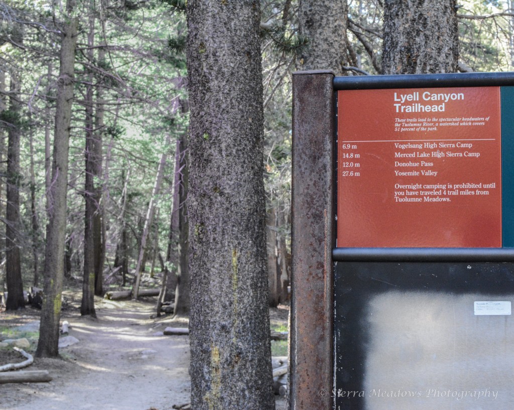
Trailhead: Lyell Canyon Trailhead
Loop: Lyell Canyon and Vogelsang Loop Trail (found via AllTrails)
Distance: 19.6 Miles (1-3+ nights depending on your side trails and/or abilities)
Time of Year: Summer (End of June) *COVID
Traffic: Low *COVID
Maps: AllTrails (Downloaded) & Trails Illustrated Map 206: Yosemite National Park
Trail Background
Tuolumne Meadows: What’s it all about? Check out the NPS info here.
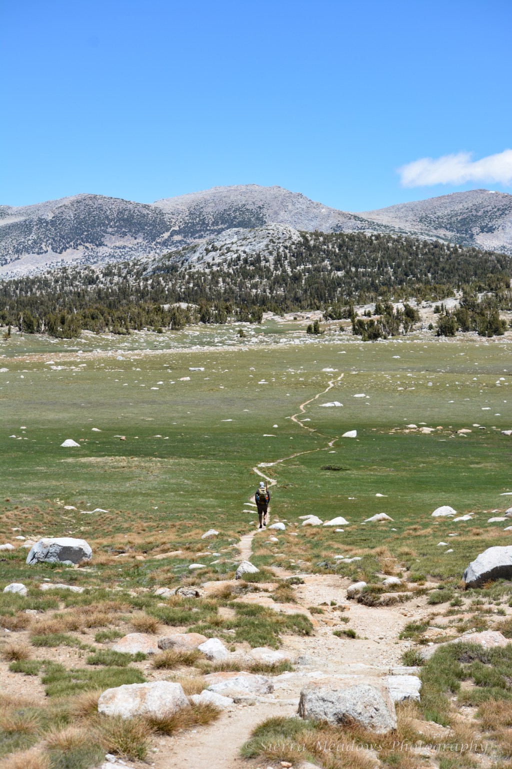
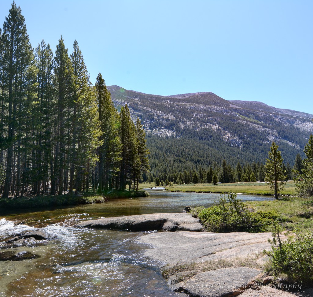
Tuolumne Meadows is an iconic high-elevation meadow in Yosemite National Park on Tioga Pass Road. Tioga Pass is the area of the park that is filled with high-elevation lakes and trails and a different vibe than the valley floor below. Lyell canyon is a sub-alpine meadow of Tuolumne Meadows and intersects with a variety of popular trails, like the John Muir and Pacific Crest Trail.
The direction that we went takes you to High Sierra Camp and Vogelsang Backpacker’s Camp, where you have a high elevation gain and can branch off and visit many lakes and other trails with day trips.
The Loop:
Start/End Point: Tuolumne Meadows Visitor Center
Park at the visitor center, make sure your permit and/or pass is displayed, and lock up your vehicle. The center took us a second to find because it’s hidden by trees and you need to make a turn off the road to make it into the parking lot. You will make your way south-bound on the Pacific Crest Trail, where you will find the Lyell Canyon Trailhead sign.
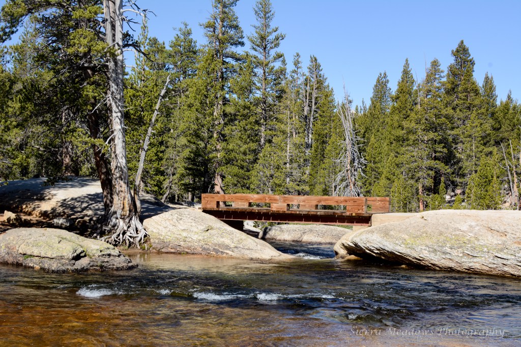
Mile 1: Twin Bridge
At about 1 mile, you will cross over Twin Bridge, which is where you will use a bridge to cross over the Lyell Fork of the Tuolumne River. At this point, you will really take in what the meadow is all about.
Mile 2: JMT/Rafferty Creek Trail Junction
About two miles into the trail, you will come up to this junction. There are two ways to go. The first option is a relatively flat hike on the John Muir Trail for about 6 miles and slow-winding switch backs up through the tree line. The second option is a steadily climb and elevation gain for 6 miles above tree line following a rocky and stony pathway. Since it’s a loop, you’ll get the best of both worlds.
Where did we start and end?
We opted for the latter. We decided that since we were energized and it was a beautiful morning, opting to go slow and make our way up first thing would be better than facing the climb at a later time.
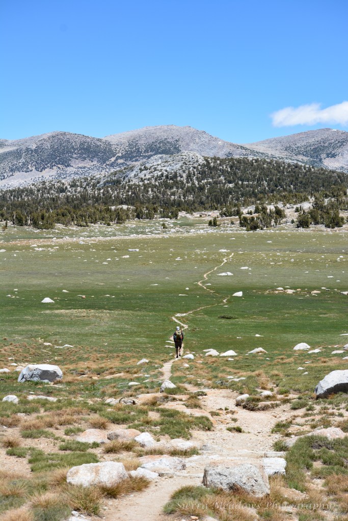
Mile 2 to Mile 7: Rafferty Creek Trail
For around 5 miles, we hiked a ~1500 elevation gain to the Vogelsang Trail Junction. The soft dirt trail is replaced by granite steps moving directly up the ridgeline as you lose trees and get more of a taste for the Eastern Sierra environment of scare trees and ranges of peaks in the distance. The trail itself was still green, lined with trees on one side, and had plenty of water running from the creek.
We did stop more than usual on this trail. On prior trips, we were prone to altitude sickness, so we did our best by moving slow, drinking plenty of water, and taking more snack breaks. We made fuel a priority over moving quickly. The one thing that we did not expect on this trail were mosquitos. With the amount flowing water, they were everywhere!
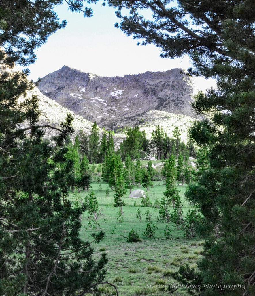
Mile 7: Fletcher Lake (Night one)
Around this time, you will see the junction for Vogelsang- you can bi-pass it and head toward High Sierra Camp. The camp was closed, so we made our way to the lake and set up a tent. There were other hikers jumping in the lake or taking a break from day hiking.
We found a spot in the meadow and pitched our tent. The trees were scarce with the high winds. We spent time by the lake and once the sky grew darker, everyone disappeared and it was just us.
In the middle of the night, the moon was in full glow overhead and you could see the whole valley in moonlight.
Side hike: Townsley Lake
On the map with no visible trail is Townsley Lake. We did a short hike here to fish and eat lunch. It is only ~15 minutes from Fletcher.

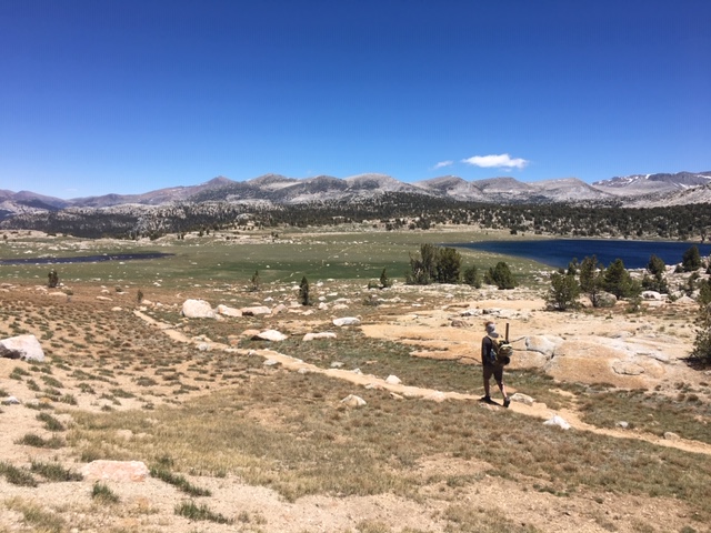
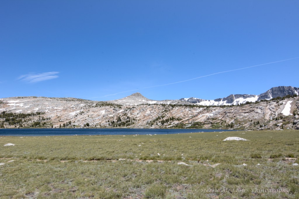
Mile 9: Evelyn Lake
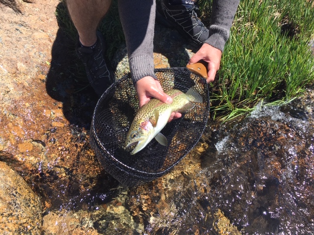
After a quiet hike, we rounded the corner to another valley. It had sweeping views of the mountain. We stopped here and took another fishing break- the best fishing spot of the trip.
Mile 12: Ireland Lake Trail Junction
With the stretch of wind dying down, we made it to a junction. There is a 1.5 mile side trail to the lake. Instead of extending our trip, we decided to press on.
Mile 14: Ireland Creek Trail/JMT Junction
As we descended the switchbacks, we were finally back in the trees and away from the wind and mosquitos. Less than a mile in, we camped along the trail. We had a nice grassy spot and saw the first group we’ve seen all day. With no mosquitos or wind, we were able to say out of the tent longer and fish in the evening.

Mile 15 to Mile 18: John Muir Trail
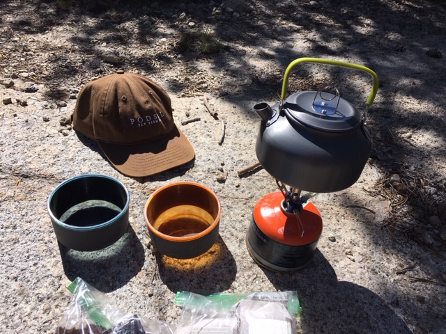
The rest of the trail was relatively flat on the way back. We were able to enjoy the weather and stop and fish when we wanted. Around noon, we made a second pot of coffee by the river and fished some more. At this point, we saw more day hikers and hikers headed the opposite way to Mt. Whitney.

Back to Twin Bridge
We rounded out the trip at the Twin Bridge with a view of Mammoth Mountain and people swimming in the creek. It was the perfect trail loop.
We did this trail in two nights. We did run into hikers who were staying at Vogelsang and hiking to some smaller lakes, so this trip can be easily extended.
Note: all mileage is approximate.
Before & After
Non-trail notable places on our journey:
Brews: Distant Brewing (Mammoth Lakes, CA) & Big Meadow Brewing (Bridgeport, CA)
Coffee: Whoa Nellie Deli in the Tioga Pass Gas Mart
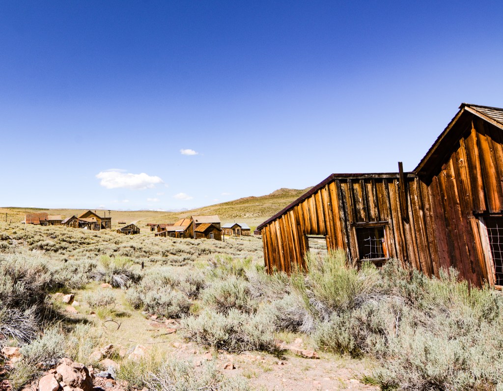
Side trip: Bodie State Park (Bridgeport, CA)

Lodging: Virginia Creek Settlement (Bridgeport, CA)


Leave a comment