

The Park
Glacier is at the northern most end of Montana. It sits on the Canada-Montana border, less than 4 hours from the Idaho border, and 5 hours from the Washington border. The park bleeds into Canada, and combined the parks are known as the Waterton-Glacier International Peace Park. There’s one road that connects the west and east sides of the park (much like in Rocky Mountain) and you need a permit to access the road.
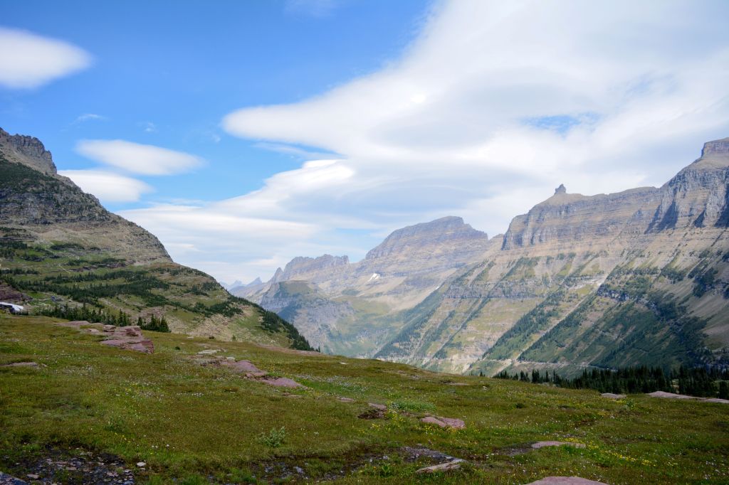
The park is named for one of the highest concentration of glaciers in the lower 48 (the winner is actually North Cascades). After recent studies, there are around 25 glaciers in the park, some of them almost too small to be considered glaciers according to park research. This place is not only special because of its glaciers, but also the wildlife, hiking trails, and glacier lakes. This truly is a special place, which is no wonder that almost 3 million people visit annually.
Getting there
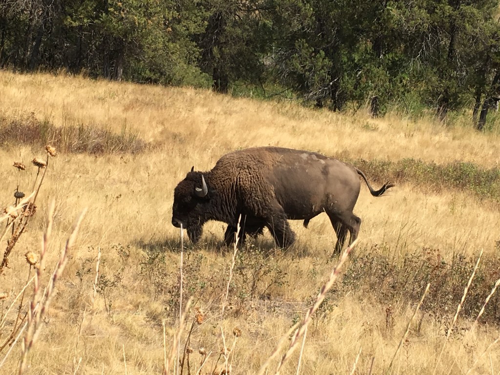
This was part of a larger trip for us- you can read about it here. We flew into Missoula, rented a car, and drove to the park. This was well-worth it. You pass Flathead Lake and the Bison reserve on the way there.
According to NPS.gov, here are the other ways to get there:
By Car
- From the west, access to the Lake McDonald area, Park Headquarters, the Apgar Visitor Center, and Going-to-the-Sun-Road is via Highway 2 east to the town of West Glacier (approximately 33 miles from Kalispell).
- From the east, all three east-side entrances can be reached by taking Highway 89 north from Great Falls through the town of Browning (approximately 125 miles) and following signs from there. The St. Mary Entrance is the eastern entry point of Going-to-the-Sun-Road and provides access to the St. Mary Visitor Center.
By Air
- Glacier Park International Airport is located near Kalispell and is approximately 30 miles west of the West Entrance.
- Missoula International Airport is located approximately 150 miles south of the West Entrance.
- Great Falls International Airport is located between 130 miles and 165 miles east of the St Mary, Two Medicine, and Many Glacier Entrances.
Campground
We stayed at Avalanche Campground in west Glacier, ~15 miles from the West Entrance to the park. The campground used to be first-come, first-serve, but with the growing number of people, it is now reserve-only at Recreation.gov.
The road to the campground follows the length of Lake McDonald, so you will already get a taste of the beautiful scenery the park has to offer.
The campground was the perfect spot for our weekend adventure- we were able to hit the trail to Avalanche Lake right from the campground and there was a free shuttle stop at the campground as well. Once you were in Glacier, this was the perfect jumping off point for your low stress adventure. The campground itself was everything you would want in a campground- minus showers- enough space to feel like you are not right next to someone and a lot of tree coverage.
The Trails
What to do when you only have one full day in Glacier? Trails are the must!
We were able to hike two complete trails while we were there. We also took the shuttle and made a few extra stops to check things out.

West Glacier: Avalanche Lake
Out-and-Back: 4.5 Miles
Crowd level: 5/5 (Summer)
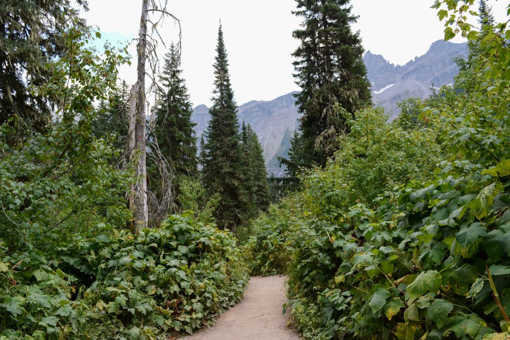
This trail starts off as Trail of the Cedars, a short hike in the midst of old growth red cedars and ferns. This trail passes over Avalanche Creek- a picturesque spot to look into the Avalanche gorge. After researching this trip and seeing all the beautiful photos, I was happy to see that the gorge was exactly what I thought it would be- and just as beautiful in person.

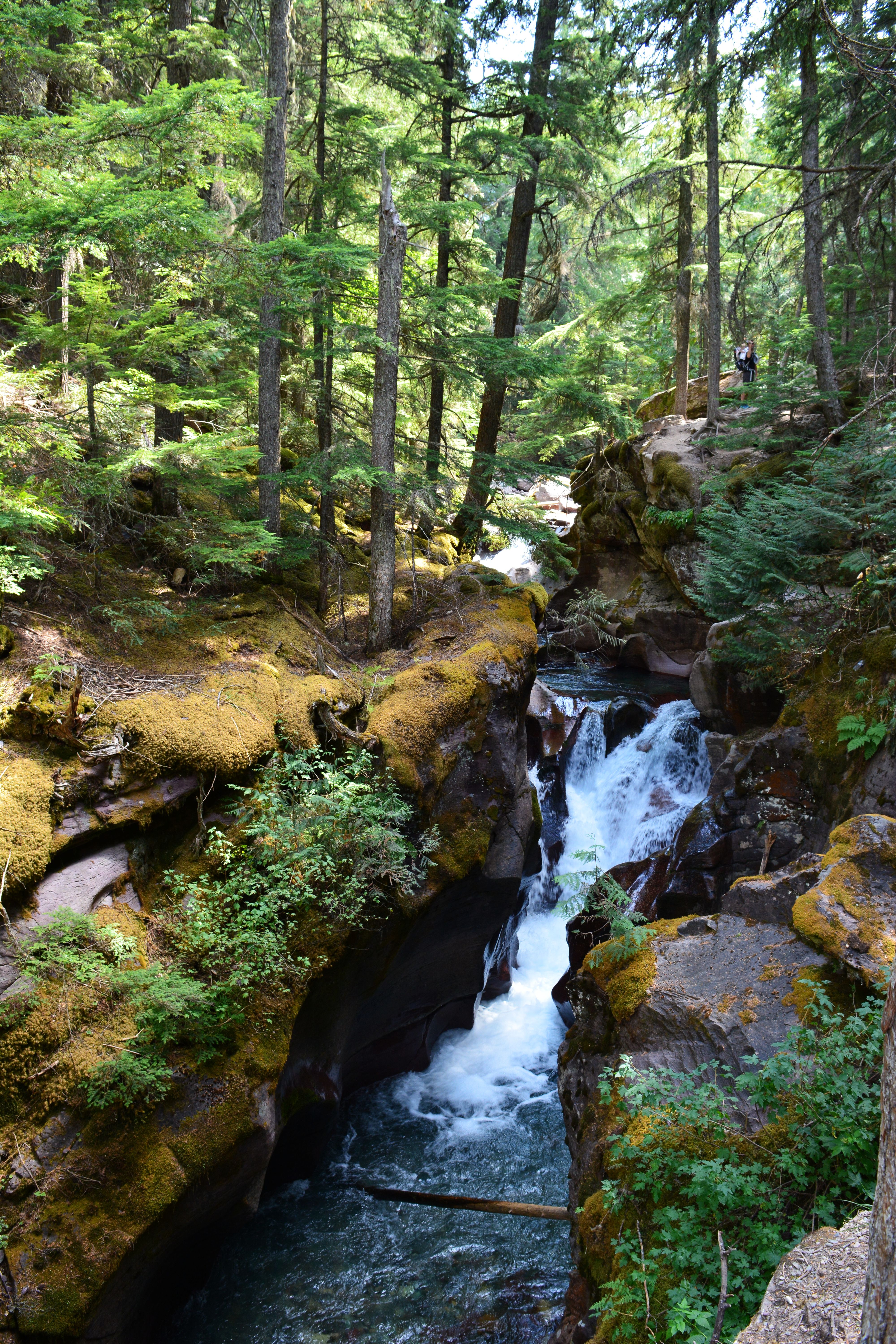
You meet up with Avalanche Lake Trail and follow the creek all the way to where it originates from- the lake. This trail is a well-worn dirt path with some beautiful tall trees and sections of the creek that are wider than others. The trail eventually opens up to the lake and a beach area.

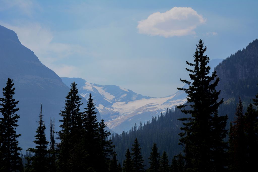
The Little Matterhorn sits at the end of this lake with its iconic long waterfalls streaming down into the lake that are fed from the Sperry Glacier that sits behind the mountain.

Logan Pass: Hidden Lake
Out-and-Back: 5.3 Miles
Crowd level: 5/5 (Summer)
Hidden Lake Trail starts from Logan’s Pass- the highest point in the park reachable by car. This is where the shuttle will stop and drop you off. If you want to keep going, you need to catch a shuttle to the other side of the park.
We took a shuttle from our campground along Going-to-the-Sun road. When we got off of the shuttle, we instantly could tell where to go from the parking lot. I was in awe- there were beautiful mountain views all around us.


The trail was a direct path to the lake, sometimes on boardwalk to ease the pressure on the wildflowers and the terrain from human feet. There were views and wildflowers everywhere.

Once you pass the overlook (halfway in), you’ll continue along a ridge, passing mountain goats and looking at Bearhat Mountain on your way down the switchbacks to the lake.


At the lake, there were a couple spots to claim as your own, but it was mostly boulders and trees that surrounded the lake.
Notable Stops
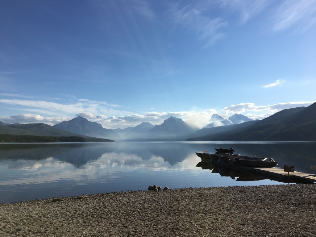
Lake McDonald– we didn’t spend too much time here, but when we dropped off our rented fuel canister, we caught it vacant in the early morning. It was beautiful. If we go back, I would love to kayak or just spend some time at the lake.
Whitefish, MT– We stopped here briefly on the way to Glacier, but we didn’t have a lot of time! It had a cool vibe with cute shops. It’s a total mountain town year-round.

~*~*~*~*~*~
I can’t wait to go back to Glacier for my next adventure. Do you have any must-do suggestions?
Hike on,
C

Leave a comment