


NOTE: As of 12/20/24 this area is closed due to road maintenance. Always check current conditions: Current Road Conditions – Olympic National Park (U.S. National Park Service).
Trailhead: Hoh River Trailhead
Out & Back: Hoh River Trail (Trailhead to 5 Mile Island)
Distance: 10 miles RT (36 miles if you extend to the glacier)
Time of Year: Summer (Beginning of August)
Traffic: Heavy, especially the first 2-3 miles
Maps: Olympic National Park Map from National Geographic (physical copy)
Trail Background
This trail is located in the United States’ last remaining temperate rainforest- the Hoh Rainforest. The trail itself is named from the Hoh River, a river that has carved itself from the top of Mt. Olympus to the Pacific Ocean. If you aren’t familiar with Mount Olympus, it is the tallest mountain in Olympic Mountain Range with eight known glaciers.
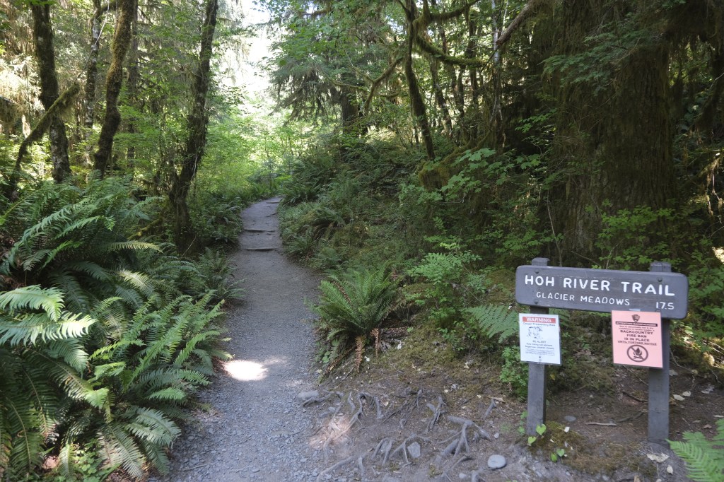
The trail extends from the Hoh River Visitors Center to Glacier Meadows- approx. 36 miles RT. You can stop at various points along the trail and make it your own trip depending on your needs/abilities. In the right conditions, it is open year-round.
We chose 5 Mile Island because it was a quick overnighter as part of a larger trip we planned. It was also a no-brainer on saving money on lodging for one night and hiking in the Hoh at the same time. This section of the trail has very little elevation gain.
Trail Permit
To get a permit, you need to go to Recreation.gov, search for Olympic National Park [Wilderness Permit], click the green Available Permits button.

Once you are on the screen for choosing your options, choose the section of the park, the dates, group members, and location. Permits were currently not available at the time of this screenshot (April 2025), but each box tell you how many permits there are for that day. You select the day and book it.

Like most National Parks, the permits for these trails disappear quickly! Plan ahead and be flexible.
The Trail
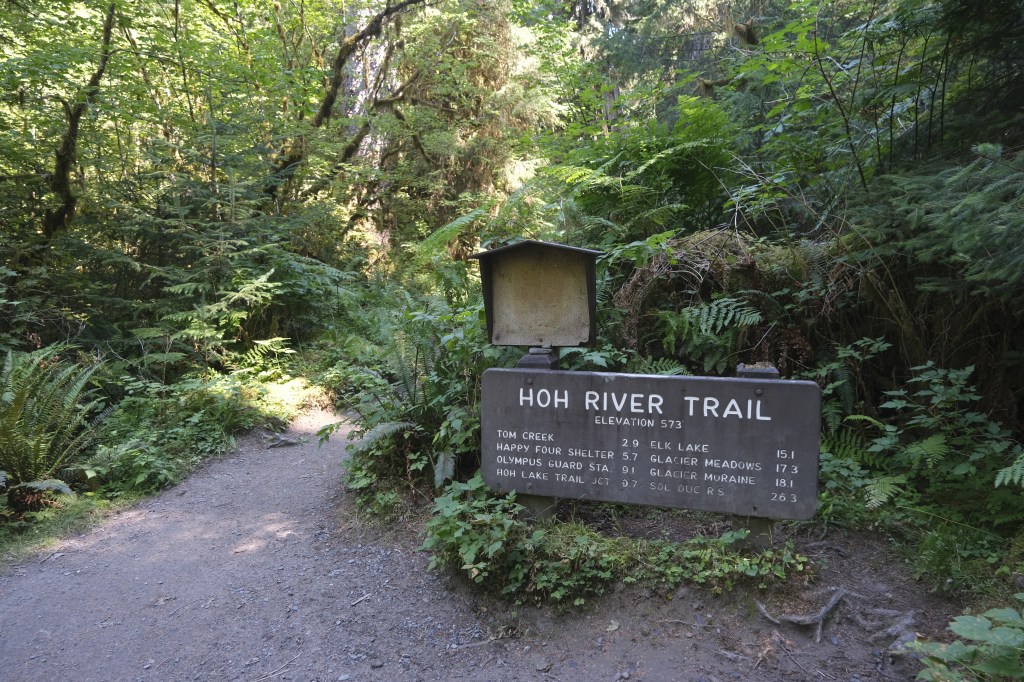
Start/End Point: Hoh River Trailhead
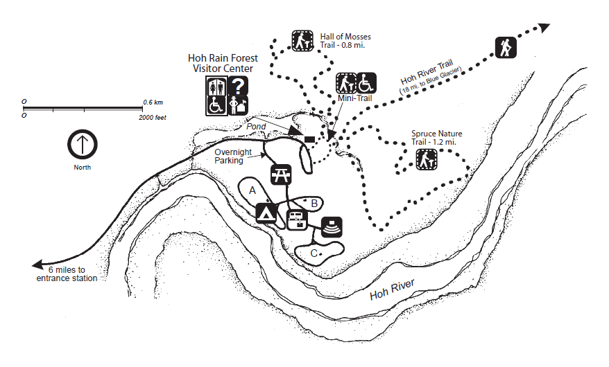
Start at the Hoh River Trailhead. It will not be as obvious because there are smaller nature trails in that section, so double check that you are not on the Spruce Nature Trail or the Hall of Mosses Trail. See map below.
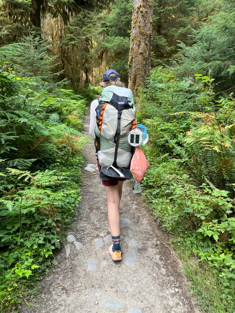
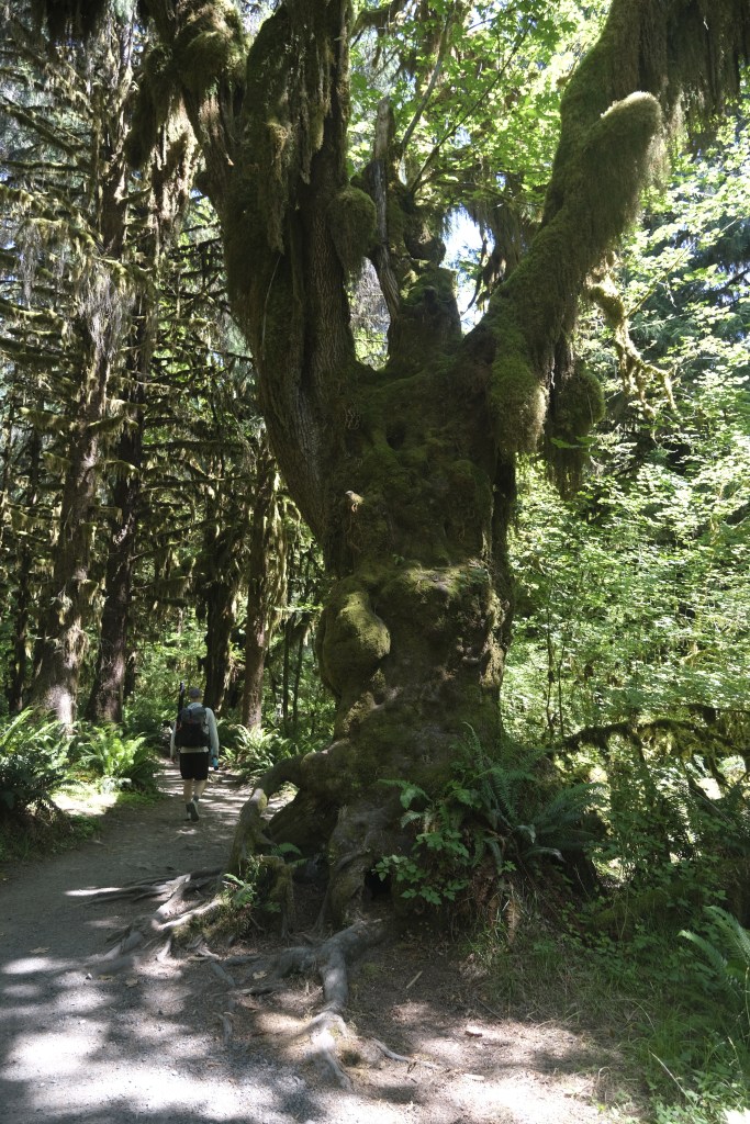
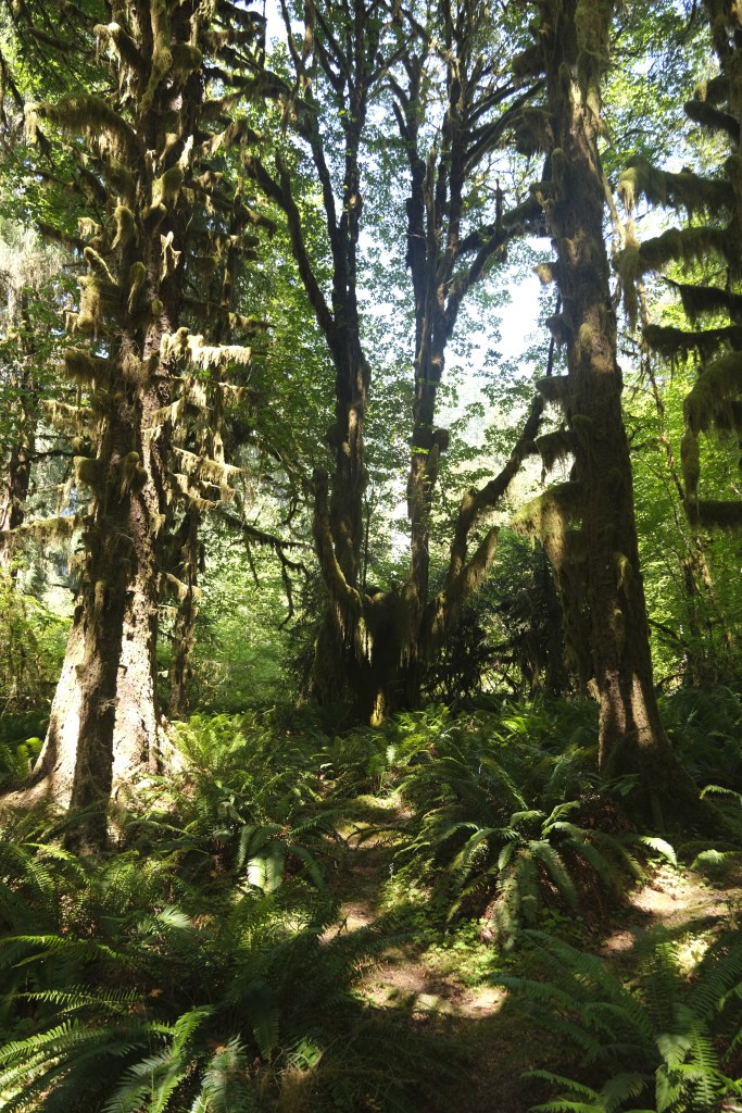
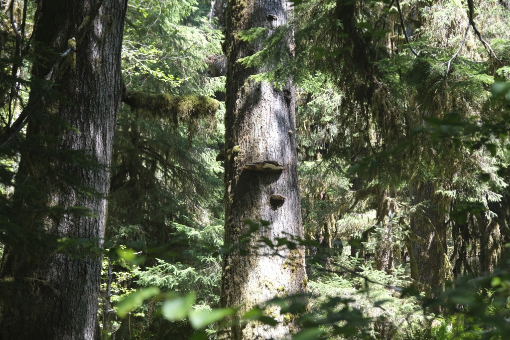
Mile ~0-2.7: Enjoy the trail
With minimal elevation change, enjoy walking through the tall trees covered with moss, lichen, and ferns. While this trail does follow the river, you will only see glimpses of it unless you turn off on one of the few side trails. The first river access is less than a mile on the trail.

Mile ~2.7: Mineral Creek Falls
Mineral Creek is a water crossing with a bridge. The falls will be to your left.

Mile ~2.9: Mt. Tom Creek
There is a signpost that will have Mt. Tom Creek with a small camping symbol. Keep walking straight.
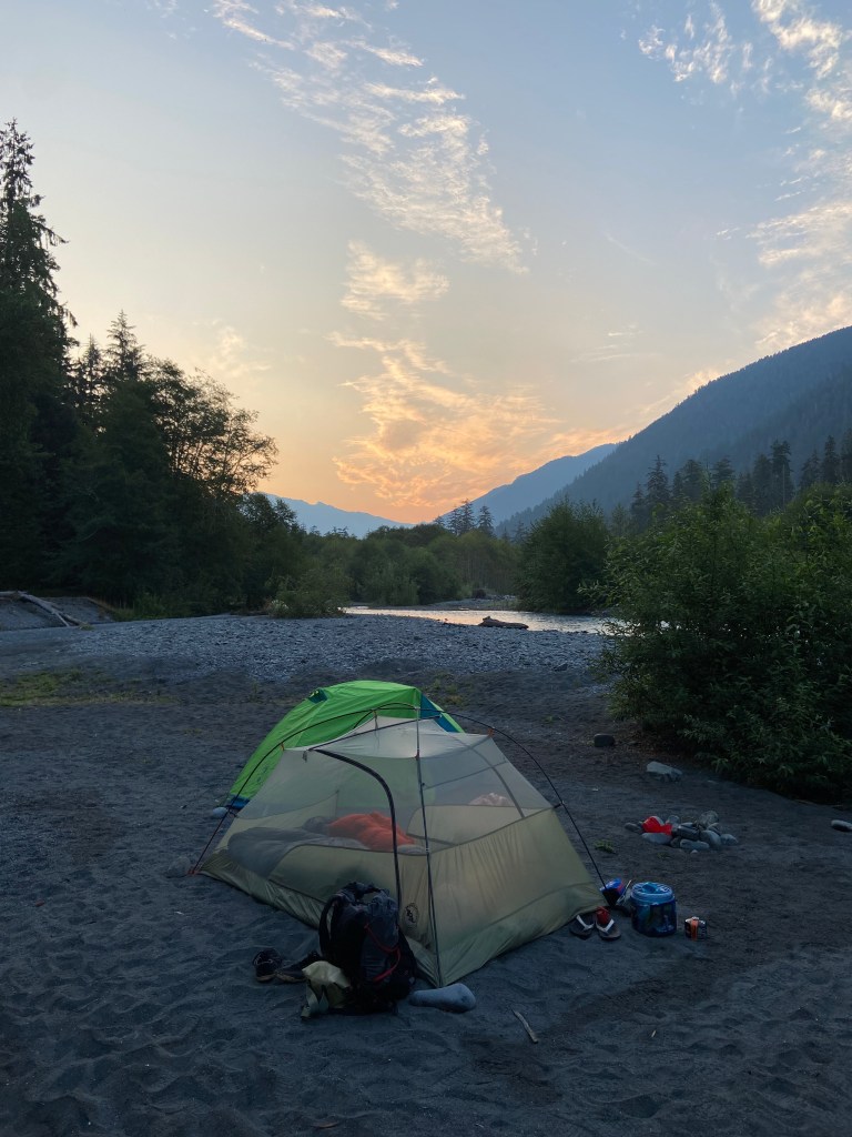
Mile ~5: 5 Mile Island
Even if you are looking to go further and just want a break, 5 Mile Island is the perfect river spot to stop. Right off the trail is a pit toilet and an open camping patch with tree coverage. Some other campers beat us to the spot and had a hammock hanging with a view of the river.
If you explore this area a little more, there is a second spot right next to the creek. There is also the riverbank with plenty of room to pitch a tent.
We chose the riverbank to do some star gazing. The wind picked up a bit, but it was a clear night.

Mile ~5-10: Everything in Reverse
One of the great things about this trail is if you miss something on the way there, you will be able to admire it on the way back, especially if you were crunched for time or if there were too many other visitors.

The Extras
My major tip for this trail is being aware that it is in a well-loved National Park. The Hoh Rain Forest alone has over 400,000 visitors annually. There is one way in and one way out, making it a fun adventure. Even with a permit in hand, we waited over an hour to be able to park our car. Plan accordingly and get there early!

~*~*~
Have you ever been to the Hoh or hiked to Blue Glacier? Leave a comment and tell us how it went.

Leave a comment