

Trailhead: Briggs Creek Campground (#1162)
Out & Back: Illinois River Trail (Southern Oregon)
Distance: ~10 miles w/ Shorty Noble Way Trail (#1185) add-on to the river
Time of Year: Early Spring
Traffic: Light
Maps: We had a trail leader, but this is a great map that depicts our route: Northwest Wildflowers: Map of Illinois River Trail, Oregon (blue line)

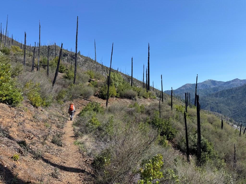
I was lucky enough to go on a day hike in the Kalmiopsis Wilderness with Siskiyou Mountain Club back in April on a recently cleared trail.
Siskiyou Mountain Club restores and maintains primitive trails in southern Oregon through various projects with the public and through a wilderness corps program. All of those favorite trails we love? They are kept alive by organizations like Siskiyou Mountain Club. This was a free guided hike, but their focus is mainly on volunteer trips.
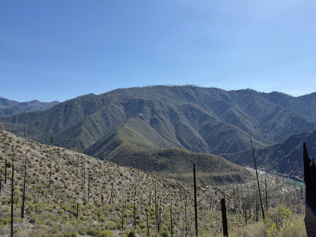
Where were we going? In a place that would represent what a true backcountry hike looks like- very few people, limited vehicle access, and bear hunters. To read more about the Kalmiopsis, go here.

Getting There
This proved to be the longest part of the journey.
We carpooled from a central location in Medford, OR to Selma, OR. Approx. a 1 hour drive.
In Selma, we turned onto Illinois River Road/ County Highway 5070. The road turns into a FS road called FS/NF 4103. Follow it until the paved road ends and turns into a gravel road. Stay to the left to continue onto 4103. You are following the river and will pass campgrounds and take-out rafting locations.
The road will eventually become steeper next to some private properties. As of spring 2025, you need a high-clearance vehicle to get to the campground. If you can’t clear this road, there is a way to park around this area and add on the miles to your hike.
This whole journey from Selma to the trailhead took approx. another hour.
Start/End Point: Briggs Creek Campground
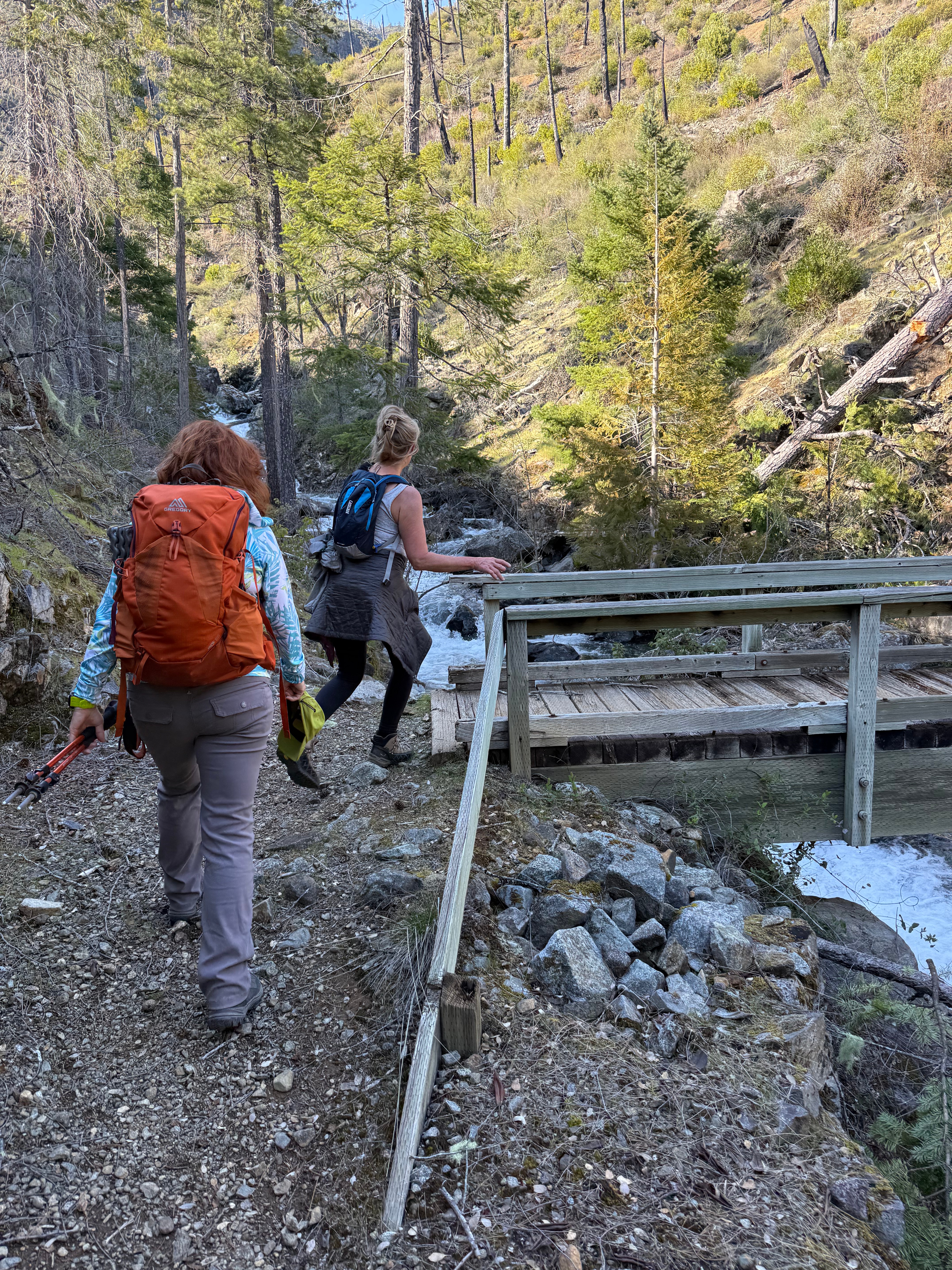
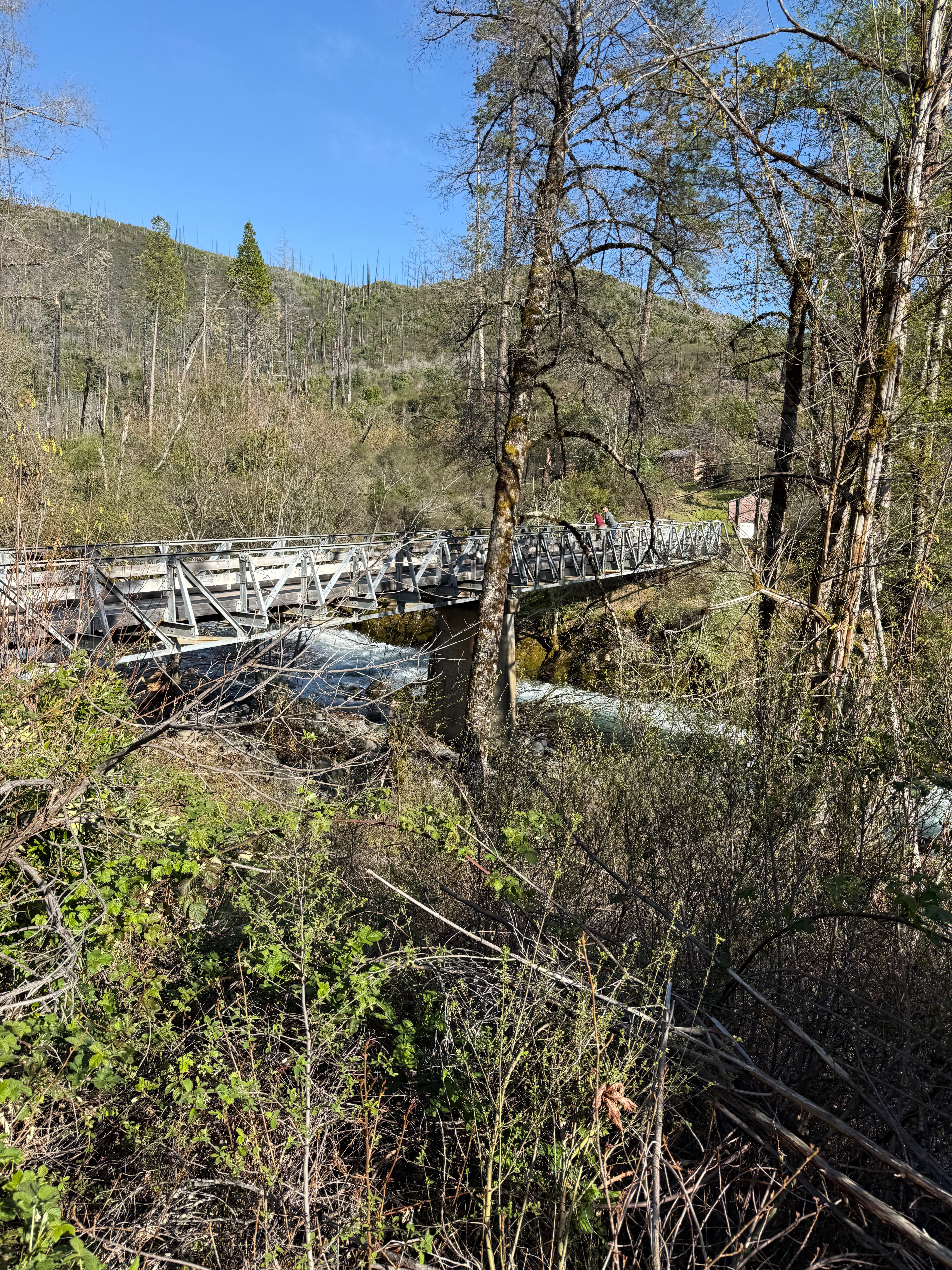
Briggs Creek Campground has a pit toilet and is next to a bridge that crosses over Briggs Creek.

Cross the bridge over Briggs Creek and continue on your way. This is a singletrack hike, meaning that it is narrow and there isn’t a place to turn off, so you just follow it until you are done then turn around.
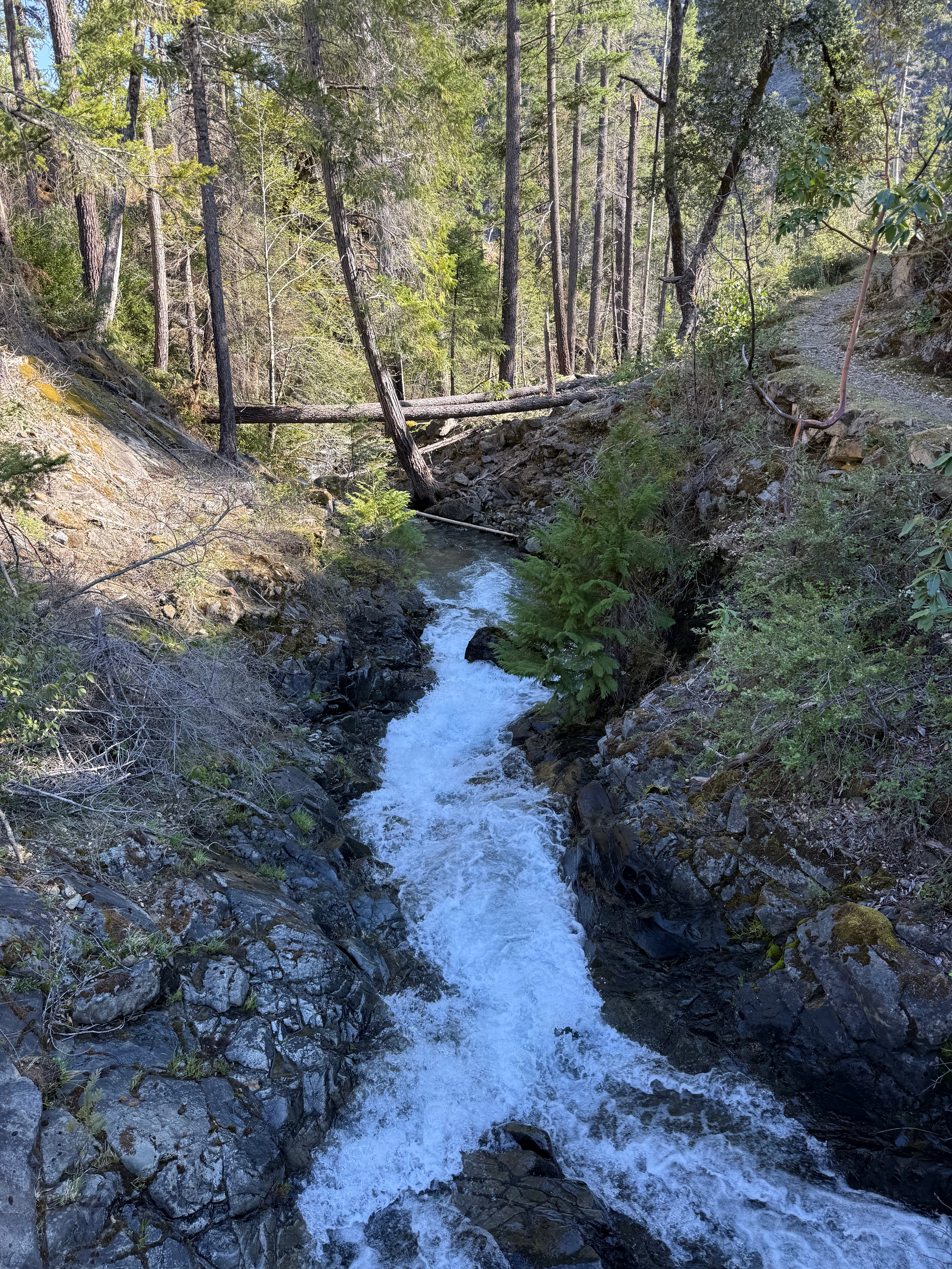
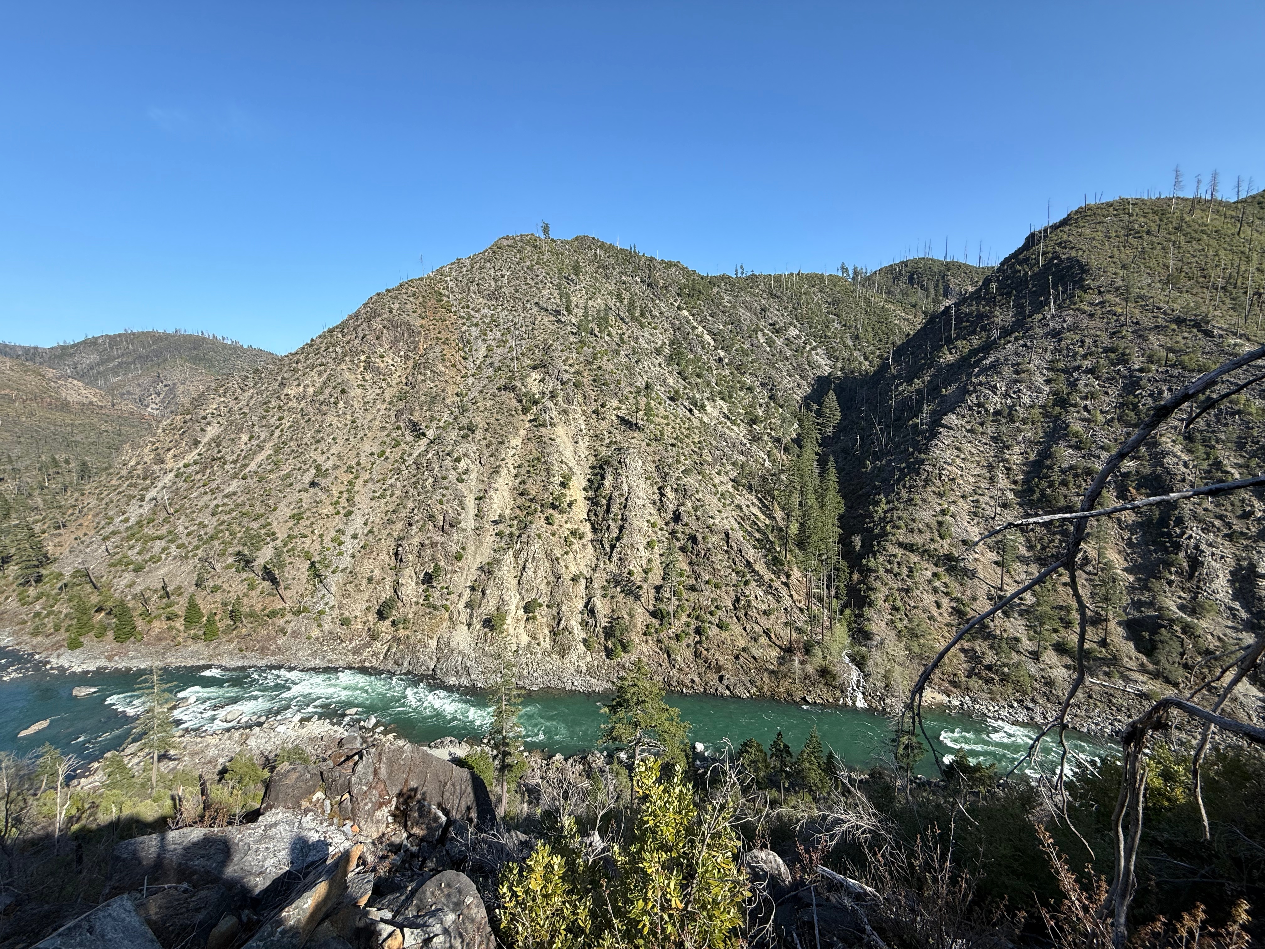
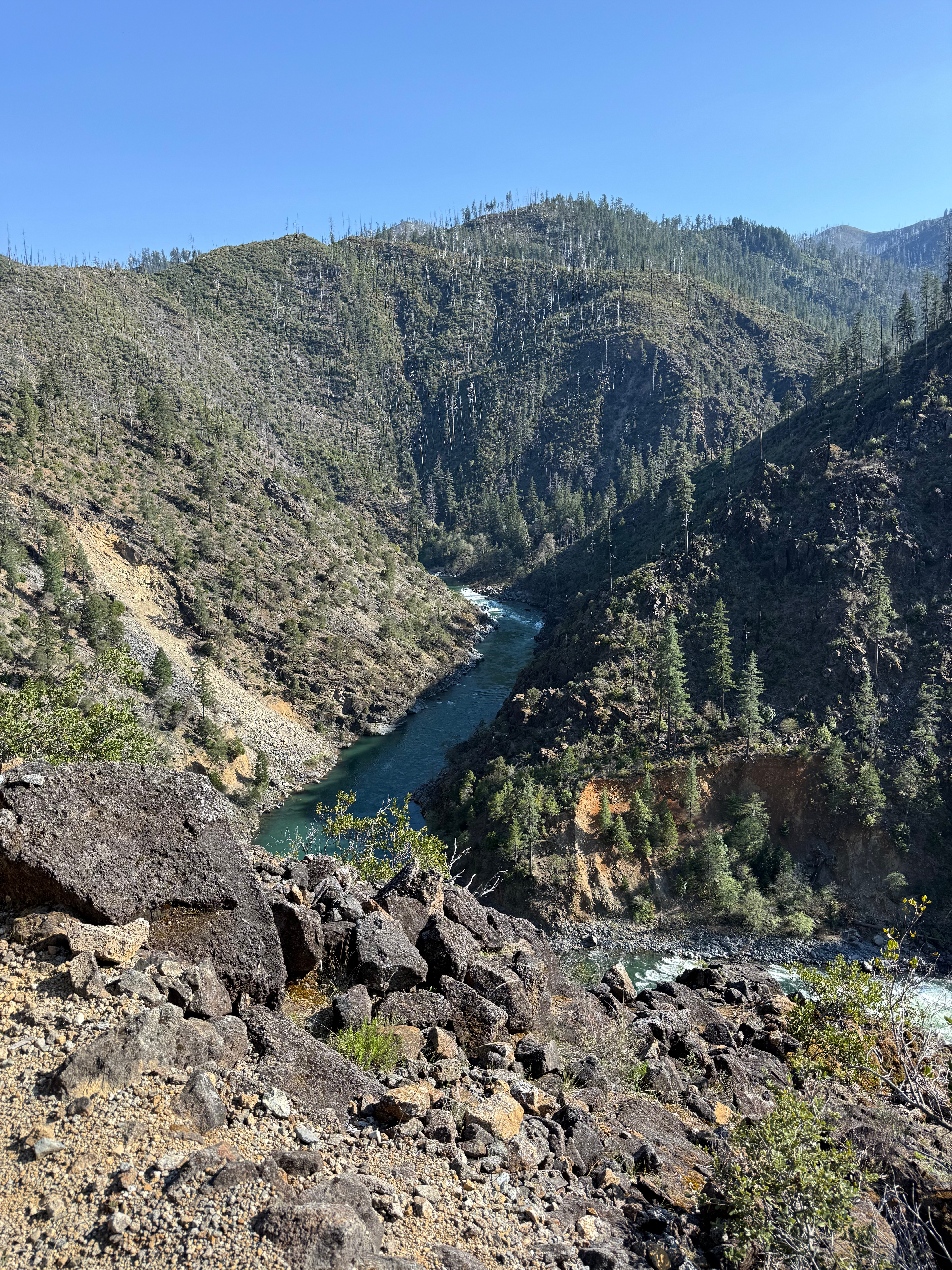
The hike has views for miles, including views of the pristine Illinois River. There are also four creek crossings. Mileage to those crossings are below.
- ~0.5: Panther Creek
- ~2: Hayden Creek
- ~2.4: York Creek/ York Creek Botanical Area
- ~4: Clear Creek/ Small campsite


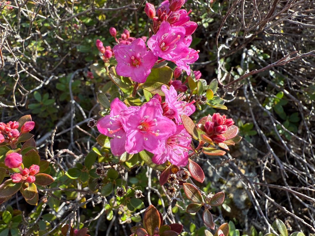
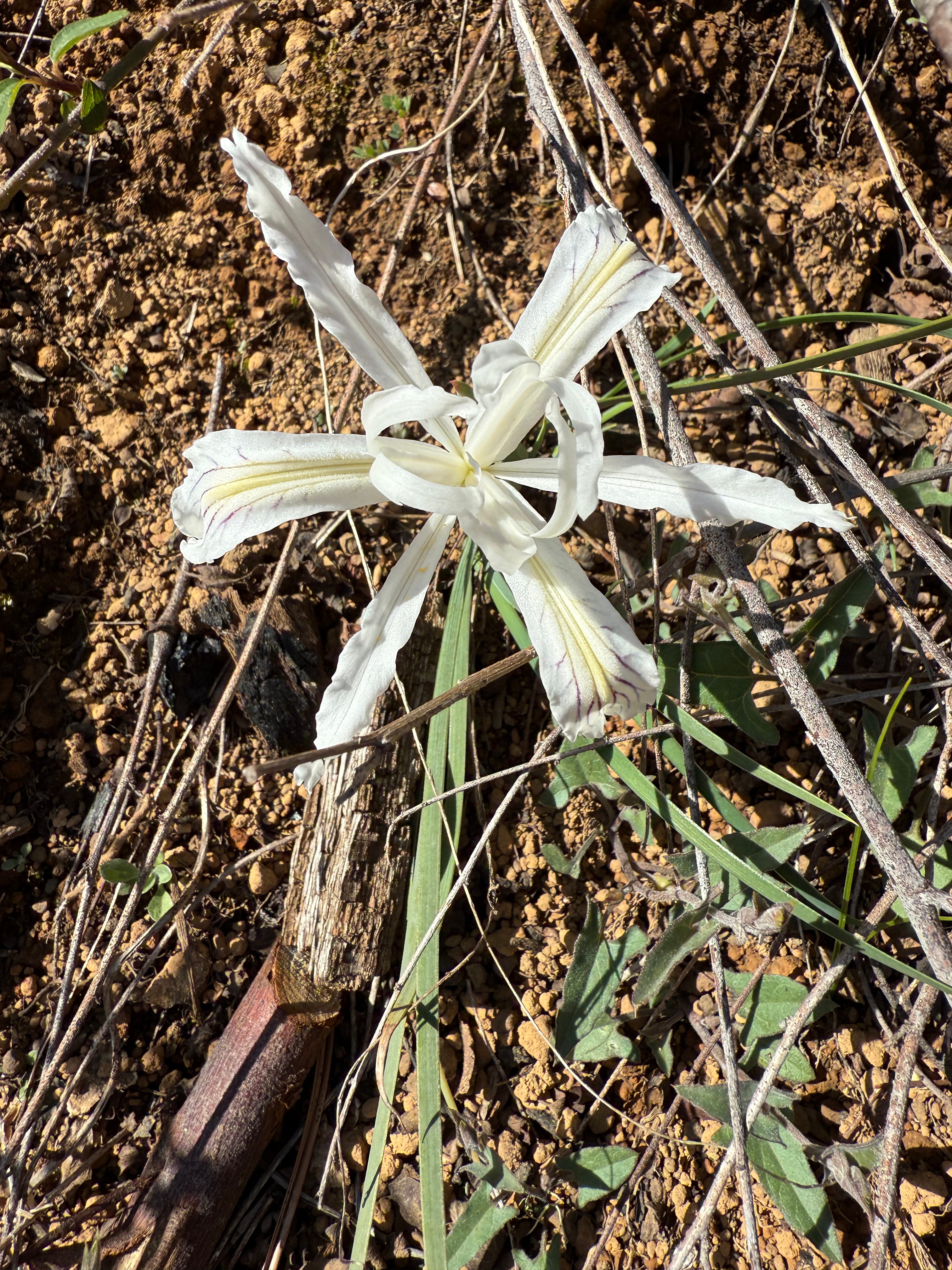
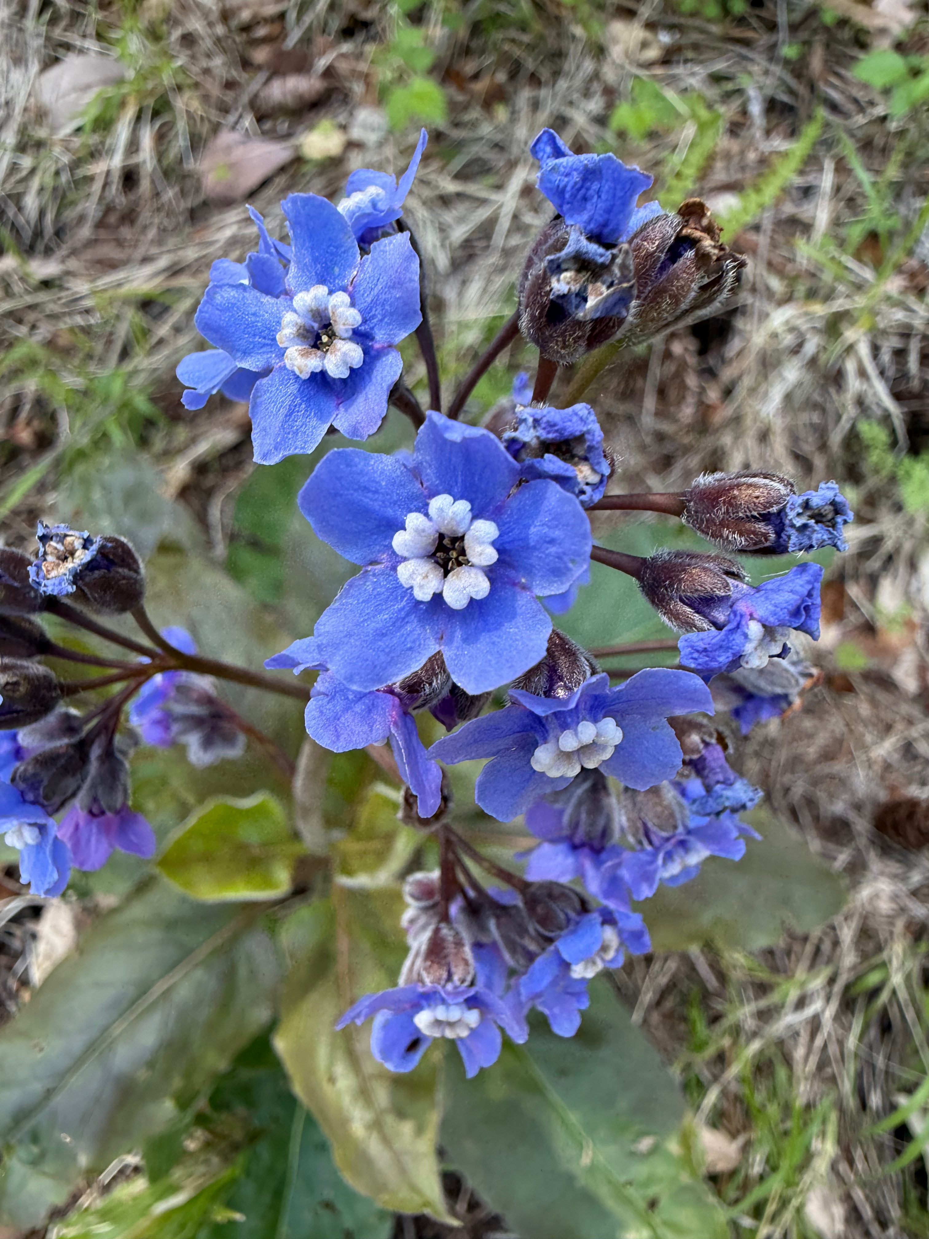
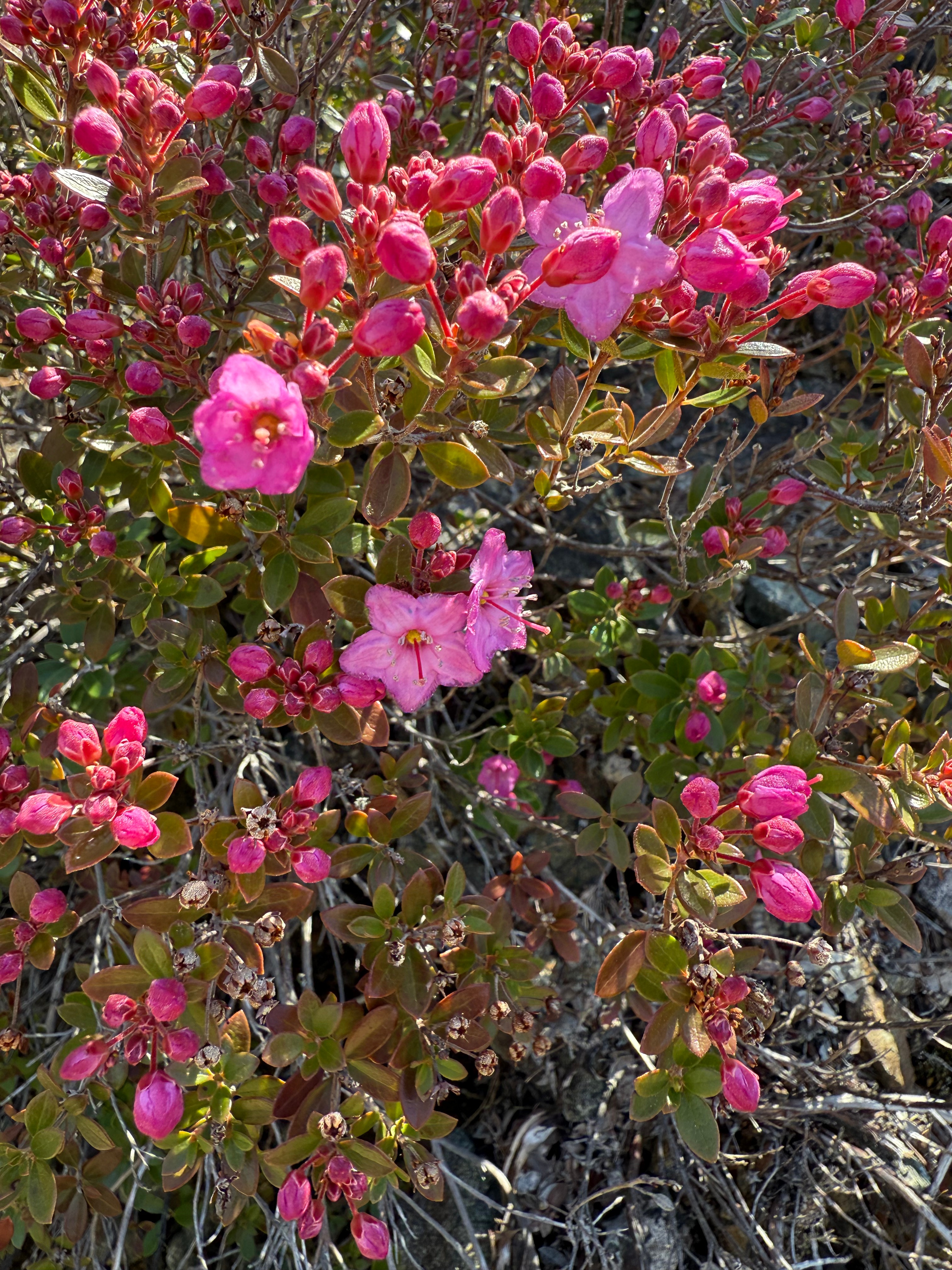
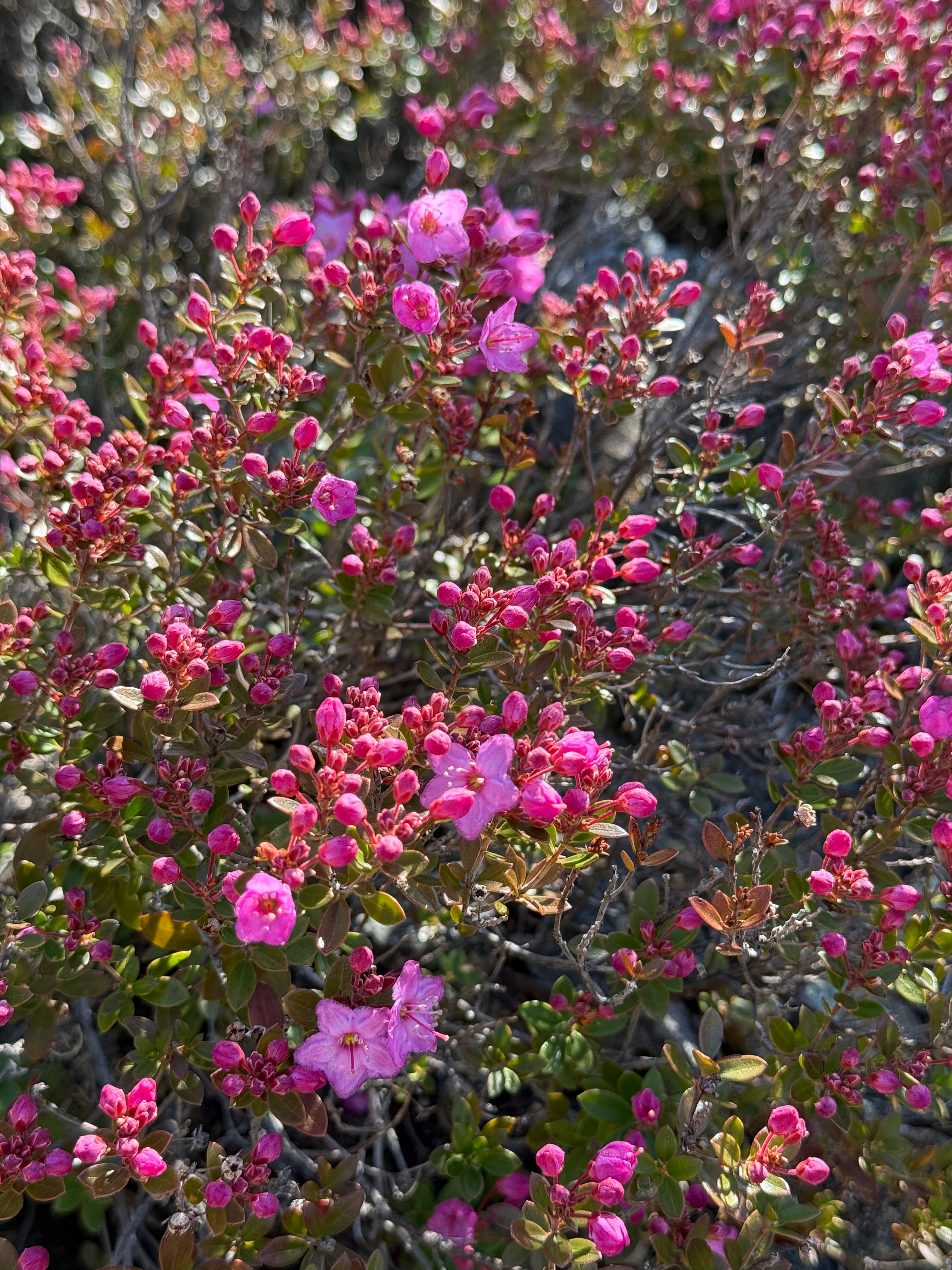
The York Creek Botanical Area Botanical Area is where we saw the Kalmiopsis leachiana, a rare flowering plant native to this area and the Darlingtonia californica, a pitcher-shaped plant also called a cobra lily. These two plants alone were worth the trip.

We took a break at the campsite and had lunch. There was a trail called Shorty Noble Way Trail that followed the creek to the river.

This added a little under 2 miles to our hike RT. There was a steep incline on the way back up. The trail itself is named after the “Last Free Man.” His cabin is listed on the map, but it no longer exists.
After we visited the spot where Clear Creek & the Illinois meet, we headed back out the way we came, passing the same creeks and plants with equal excitement.

On the way out, we passed younger backpackers heading in for the night and a few more people at the bridge.

Then we began our long journey home. The trail itself was around a 6-hour hike with our lunch stop and our travel time was around 4 hours. It was worth it.
Outdoor Safety
Practicing safety should be your number one priority when recreating outdoors. The simplest ways to be safe are true for most outdoor activities.
- Leave your itinerary with someone, even if you are hiking with a friend, group or organization. Include approx. times of arrival and departure and the trailhead.
- Wear sun protection in different forms- sunglasses, sunscreen, sun hoody, sun shirt, sun hat. They all start with sun!
- Layers are your friend. Better to have more clothes than less clothes.
- Hydrate, hydrate, hydrate. It’s better to bring more water than less water. Bonus points for carrying a water filter on longer hikes in the wilderness.
- Know your limitations and don’t be afraid to communicate them before or during a trip.
- Bring more food than you think you will eat.
- Invest in a satellite device. These are pricey, but the peace of mind is worth it. You can send SOS signals and text messages to update your itinerary, check in, or call for help. Ours is the Garmin inReach® Mini.
This backwoods hike was not the normal neighborhood walk or hike I usually go on. With that, I took extra safety precautions to ensure a positive experience. These precautions are now a habit every time I grab my day pack- whether I’m road tripping, hiking, or paddling.
~*~*~*~*~
Hopefully this post inspired you to get outside!
~C

Leave a comment