

Three Days on the Continental Divide National Scenic Trail (CDNST) Loop in Rocky Mountain National Park (RMNP)

Trailhead: Kawuneeche Visitor Center *See Note1
Loop: Continental Divide National Scenic Trail (CDNST) Loop (found via AllTrails)
Distance: ~26 (2-3 nights depending on your abilities)
Time of Year: Summer (End of July)
Traffic: Low, the trailhead is located in the quieter side of the park, quota limited by permit
Maps: AllTrails (Downloaded) and National Geographic Rocky Mountain National Park Trail Map
Trail Background

CDNST: What’s it all about? Check out the info here.
The park has very different entrances like most National Parks. The east side is known for Estes Park, the more popular home base if you are staying near the park and travelling around within it. You can also access the lakes from this side, too. We did not actually stop here, but it is widely known.
If you are looking for the quieter side of RMNP, the west side near Grand Lake might be better for you. It is up the road from Grand Lake, CO, a small family-friendly destination with a lake surrounded by family-owned cabins. The town itself has a summer camp feel with a small main street and kayak rentals.
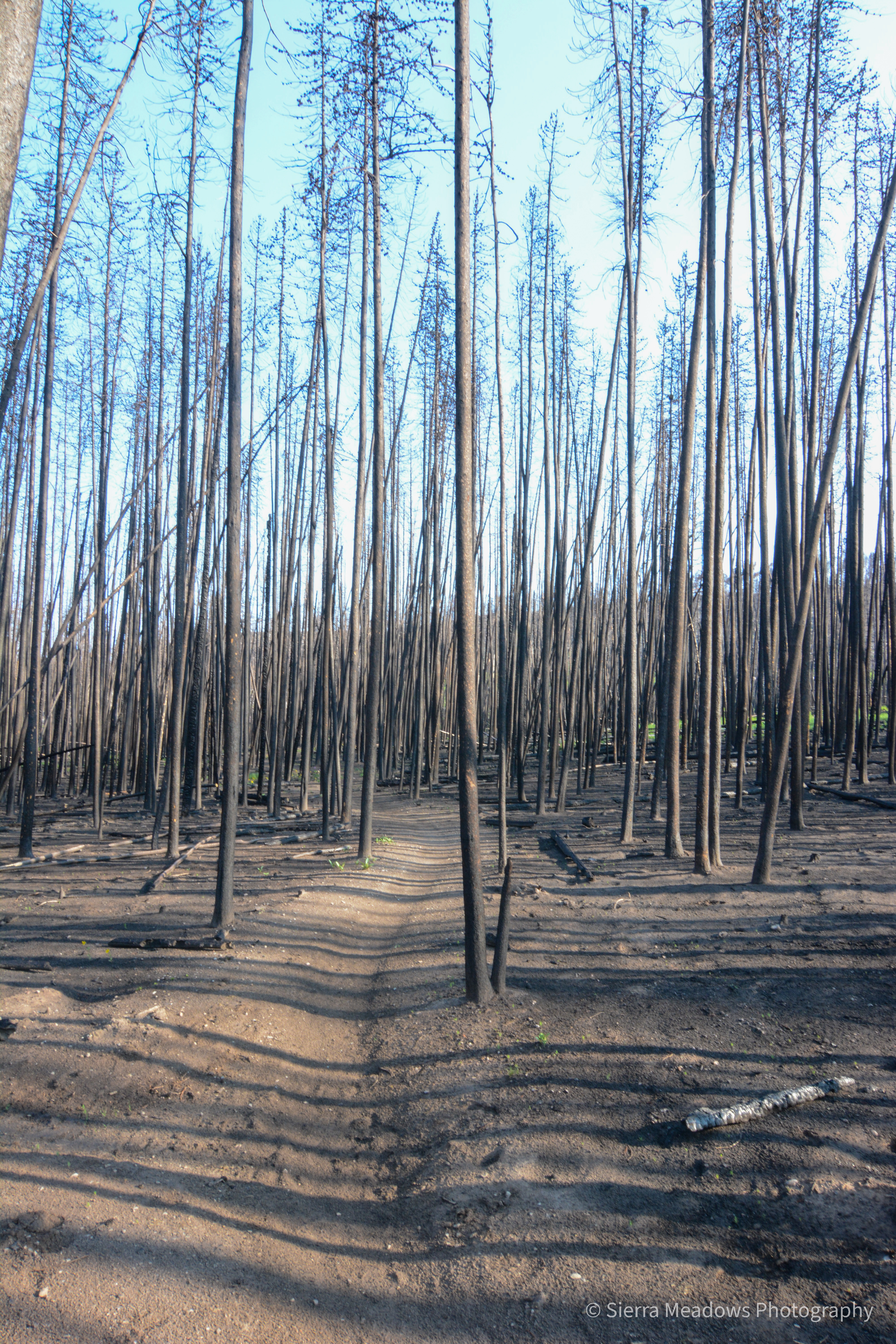
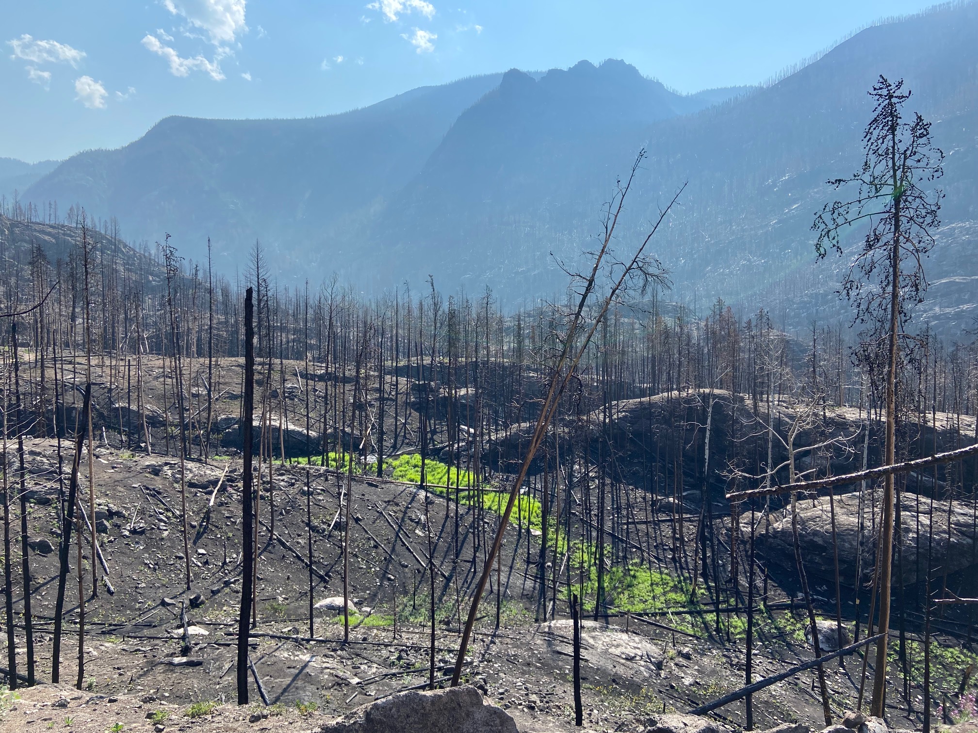
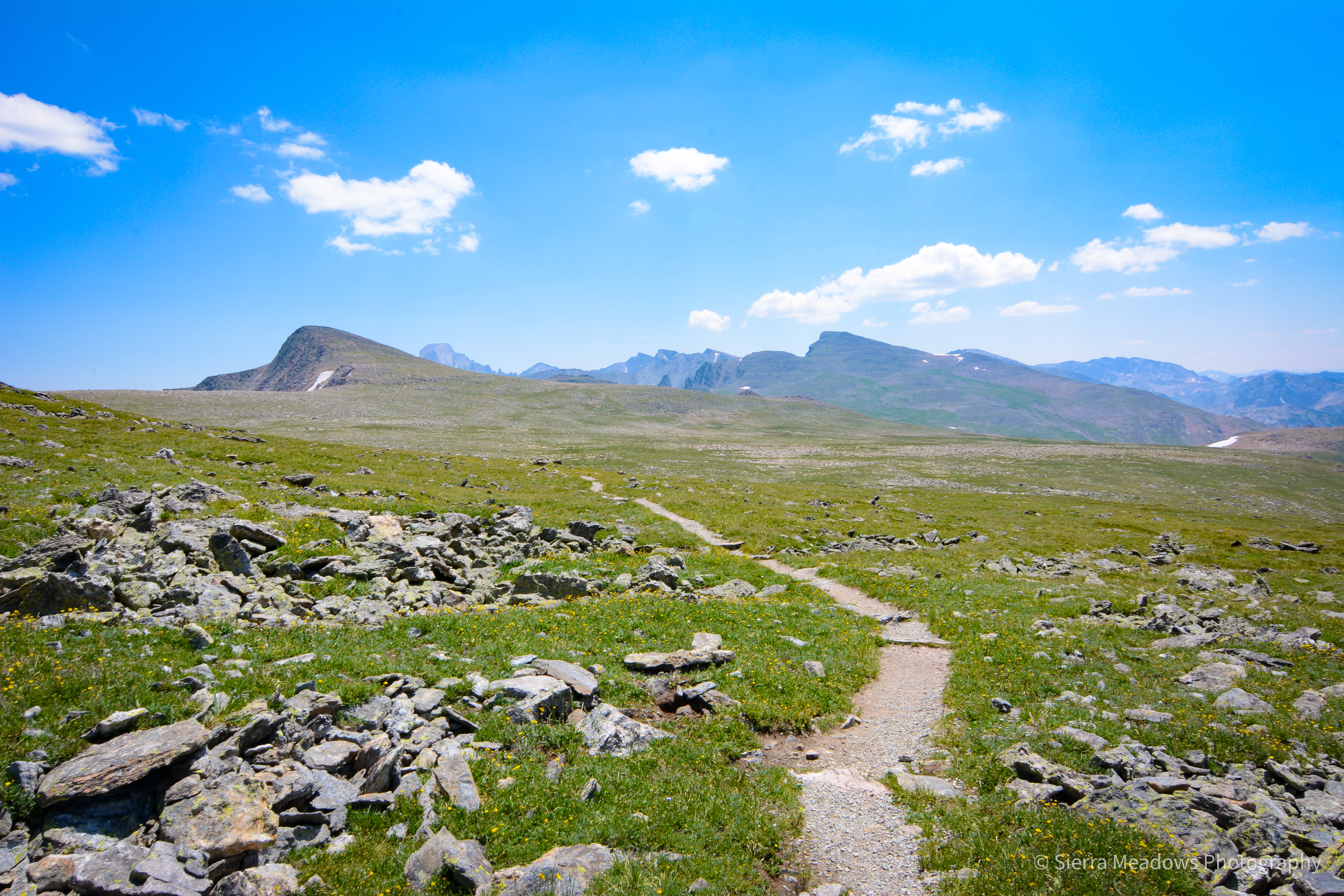
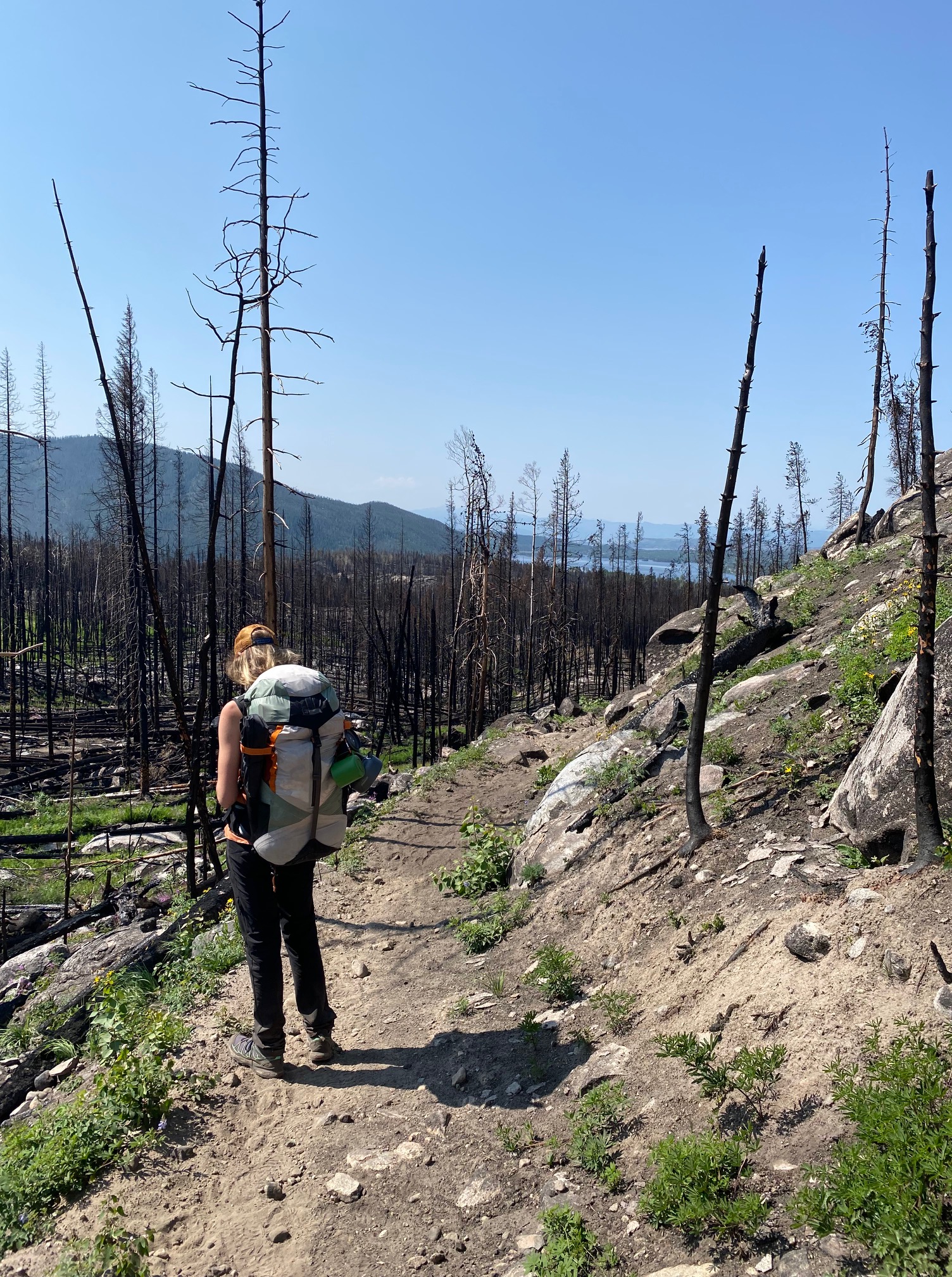
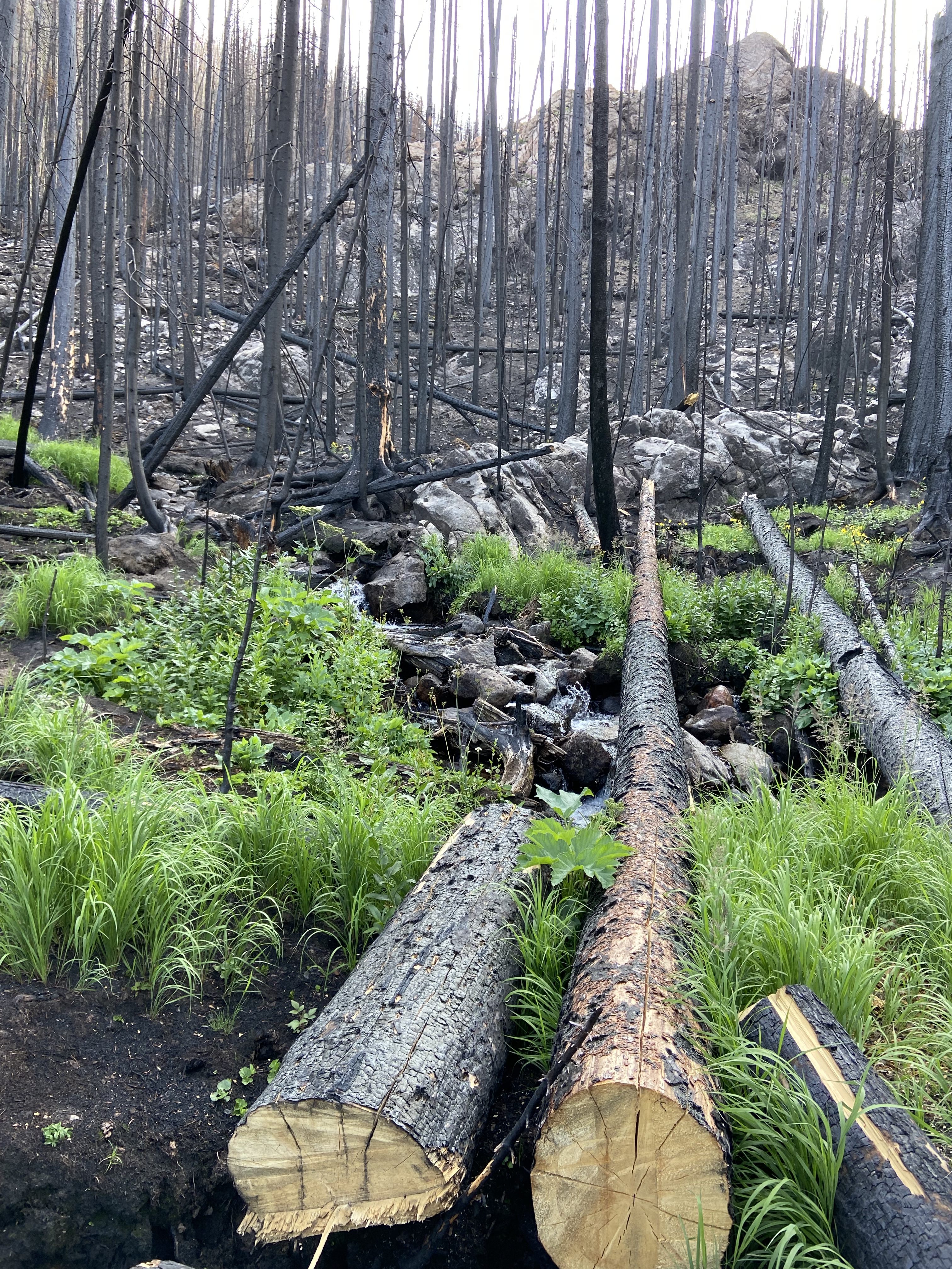
This trailhead is located on of this side of the park. The trail travels through a 2020 burn scar, rushing waterfalls in the middle of summer, wildlife encounters, and a ridgeline that is 12,000+ feet. If you are looking for views, this is the trail for you.
Trail Notes:
~This post has been a while in the making! I am trying to get better at following up right after. It’s the end of 2022 (2023 when this is posted), but we did this trail in 2021, two seasons after a wildfire. There were a few closures on the trail when we hiked it. Fortunately, this trail is more accessible and relevant now!
~This trail is at an elevation of ~12,200 feet. Please review the CDC’s recommendations on how to travel safely in high altitudes here.
~When you read more information on this trail, it is recommended to go in the opposite direction of the way we hiked. Looking back, we would have chosen to do it in the opposite direction. Unfortunately, with backcountry permits, you typically choose your direction depending on what is available and given to you. We were given North Inlet as our first night’s campground.
The Loop:
Day One:
Start/End Point: Kawuneeche Visitor Center/ Livery Trail
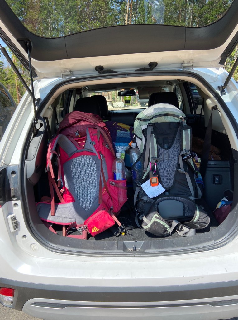
We got on the trail by 8 AM to ensure that we would have enough time to travel on the trail and to our destination. Since we were going up in elevation, facing a burn scar, and just generally have never done this trail before, we were extra cautious. This was also my friend’s first backpacking trip!
The trail started at the parking lot’s end furthest away from the center’s main building. We had a flat start from the trailhead and entered the desolate landscape of burned trees and a little bit of regrowth.
Mile ~0.6: South Tonahutu/ Big Meadows/ Onahu Creek Trail
We turned right to start our loop and continued to the trailhead entrance with similar scenery in a fog of haze. The trail turned into a road that stopped at a day use parking area, which is where the trailhead began.


Mile ~1.5: North Inlet Trailhead/ North Inlet-Flattop Junction
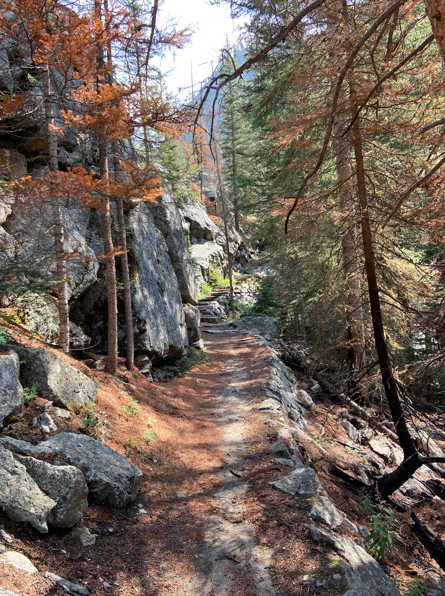
Once at the trailhead, the expected showed up- sunlight, waterfalls under bridges, and people of all ages ready to start their day hikes. From here, we gradually traversed through a burn scare and up the mountain.
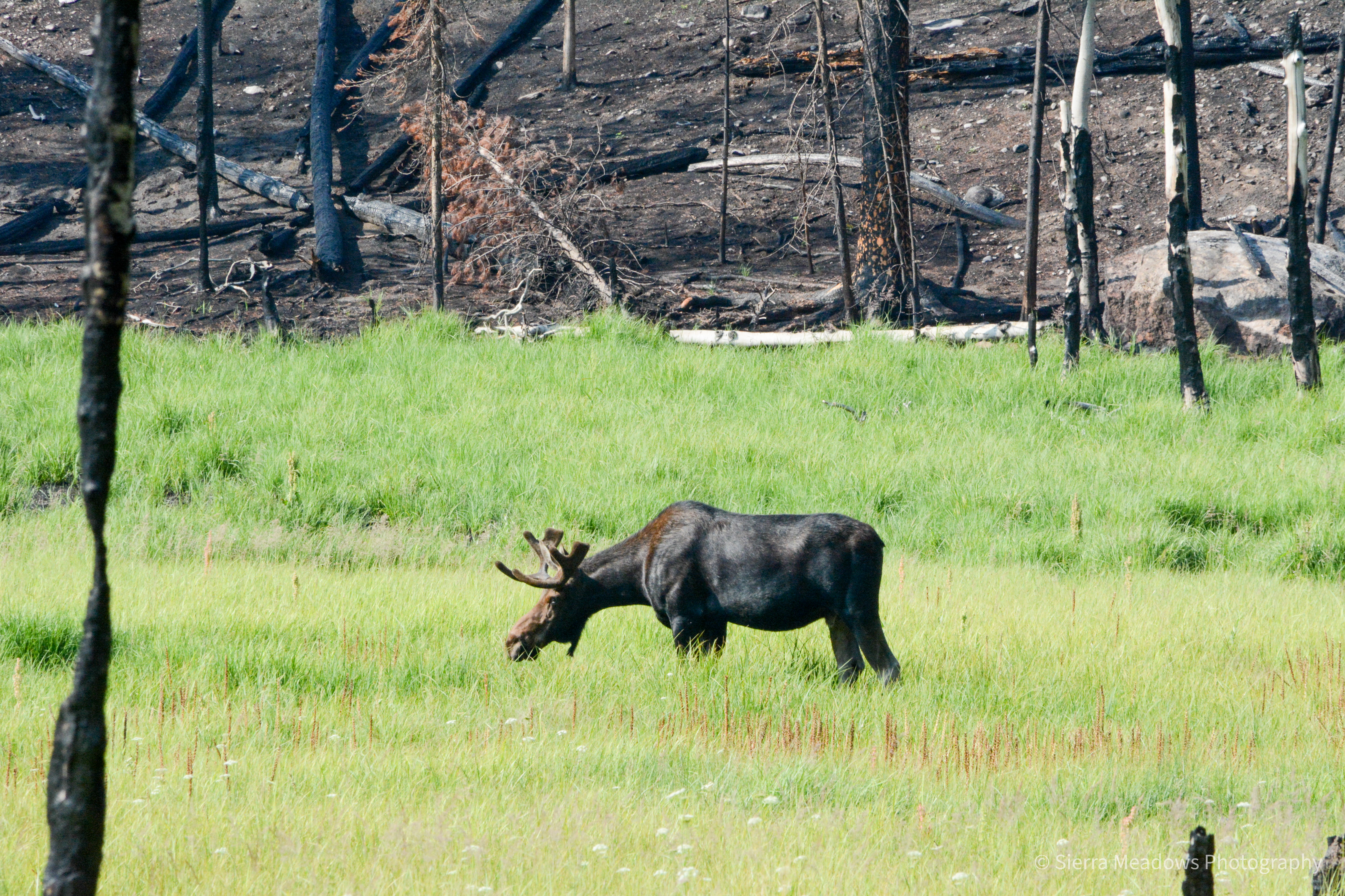
Along the way, we followed the creek. At the beginning of the hike, the creek was slow-moving with a wide-open meadow on the other side. We watched as a moose travelled alongside it, too, foraging for food!

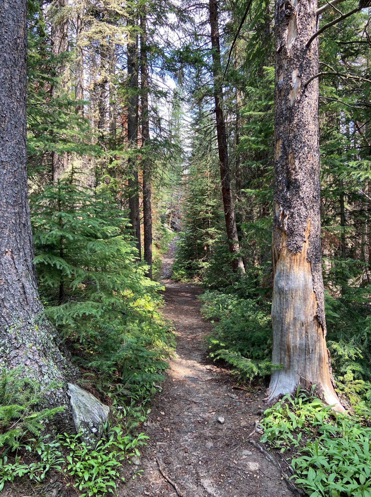
The terrain changed a bit as we continued- back in the burn scare with blackened trees and blackened soil. After a bit, we were in what was normal to us- small stops to look at the creek flow, water trickling off the mountain sides, greenery, trees, and people picnicking in any flat space they could find. It was a beautiful, gradual, and peaceful climb to our campsite from that point.


We passed a few hikers, but once we went passed the popular sites, we rarely saw anyone.
Mile ~8: North Inlet Campground
A little after 1 PM, we found our first campsite. We could have kept going, but our next stop was over the peak and we heard that we needed to travel it earlier in the day just in case the weather changed. It was going to be clear blue skies for a few days, but you never know what you might run into when you are in higher elevations. This meant we could set up camp in the daylight and have plenty of time to lounge around, read, and enjoy being outside.
Our campsite was just uphill from North Inlet Falls and near a resident campsite. We assumed it was for park workers who were doing trail work for the summer. In our campground, there were a few specific spots you could set up your tent and they were marked off by logs. We had it to ourselves, but we were pretty sure there were a few hikers at the resident campsite. We just never saw them. Overall, if you were doing a day trip or just an overnight, this was a great spot.
Day Two:
At 5 AM, our alarms went off. We were going to try to hike the farthest we could in the early morning. Unfortunately, it was still pitch black, so we yelled to each other from our separate tents until it was a little lighter outside. After we packed up, we prepared for the long stretch of switchbacks up to July Campground. We were met with small creeks and beautiful views on the way up.


Mile ~9.8: July Campground
When we got to the split- a short trail up to July or a continuation of our trail, we took a rest. We were about to travel up more switchbacks and a ~1500 feet elevation gain. This spot had flowing water, wildflowers, and you could see down into the valley where we started from.
When I think back, this part was my favorite of the trail (aside from the views at the top!) Next time, I would like to stay in July Campground for the weekend. This spot would be perfect for branching out on little day hikes.
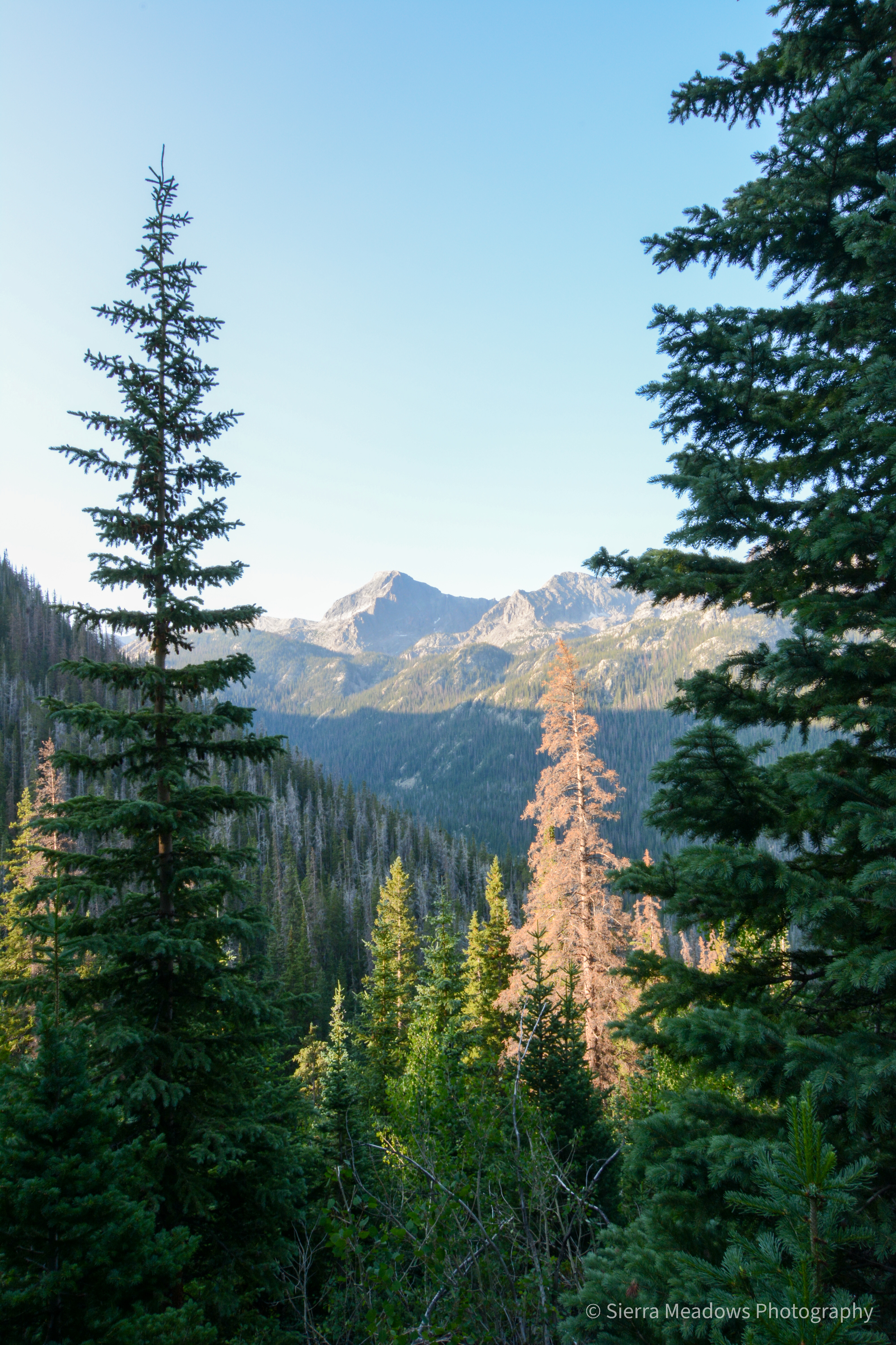
When we were ready, we hiked the switchbacks and took frequent breaks. The trail was narrow. We only saw one other group (at the campground), but we were by ourselves all the way up. The views all the way up were incredible. From the switchbacks to the junction, you could see for miles around.


Mile ~13.1-13.4: Tonahutu Creek- Flattop Junction
The trail slightly branches off at this point. You can either make a right and go down the mountain and into the eastern side of the park or you can take a left and loop back to the western side. The western side was part of our loop. There were signs at the time that this trail was closed, but the ranger said it was open for backpackers. At this point, we were travelling longer than expected and there was no water to filter since the July campground.

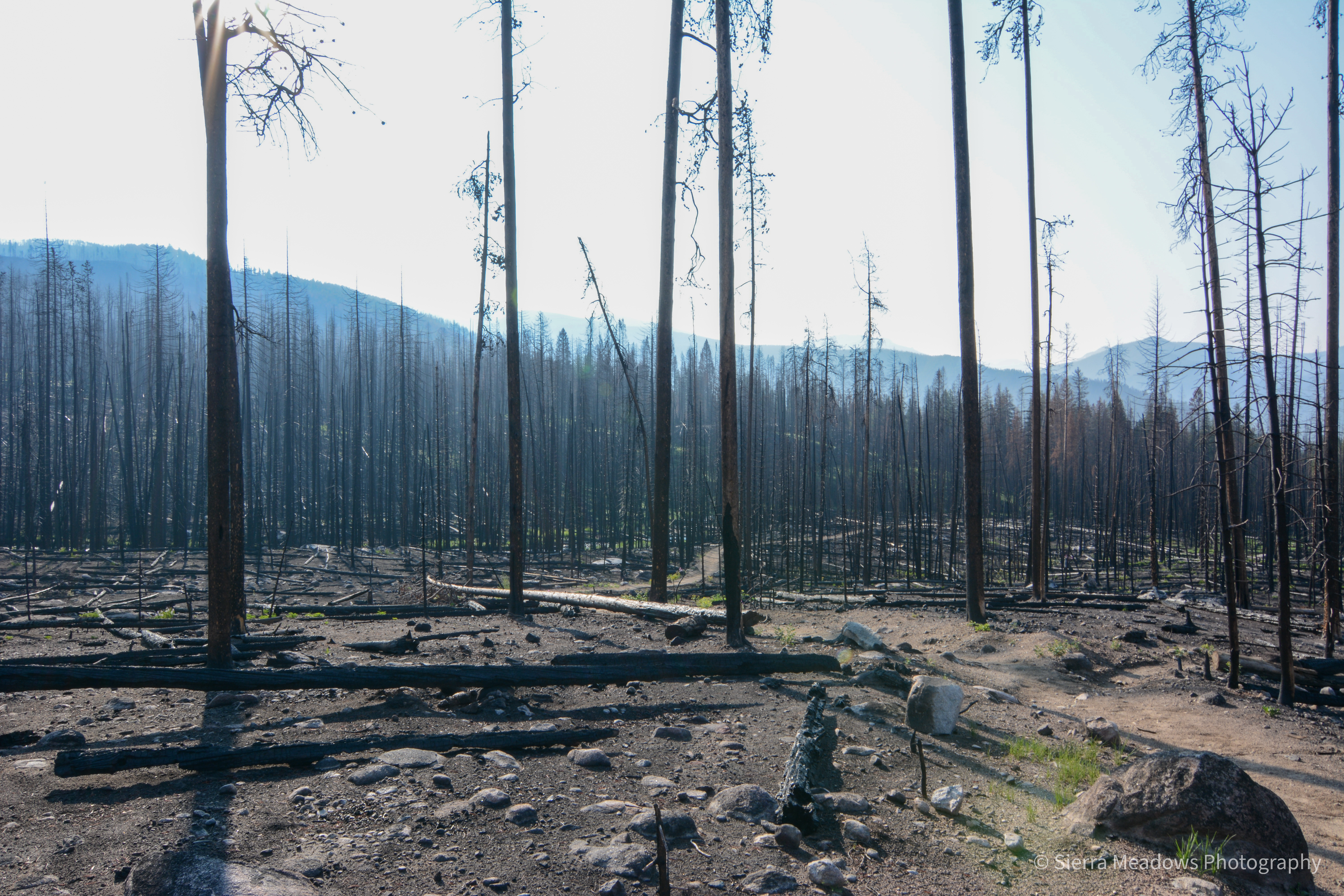
As we made our way down the mountain, we could see why it was closed. Fallen trees from the fire had blocked off sections of the trail and the bark on the trees was burned, so there was this ashy residue everywhere. In the moment, we felt that the trail was scary. After the fact, we recognized that it wasn’t as bad as we may have imagined. It was still a thin trail with a dramatic drop off, but the tree gaps were big enough to either go under or jump over. This contributed to our slow way down.
Mile ~16.9: Timberline Group Site
This was an exciting point for us because it meant the trail would be as smooth as when we started the day before with less ups and downs or larger climbs. Instead of going up to the group site, we continued on the trail. A half mile away was supposed to be our second night’s trail junction. It was. We pivoted, however, and decided to keep going even though we were hiking for 10 hours by this point. Two of the factors were: 1) the trail went directly up to where the campground was supposed to be for another ~1.5 miles and we were exhausted and 2) it was completely burned on the way up and we didn’t want to face how passable it would or wouldn’t be. I am not a person who doesn’t follow backcountry rules, but we honestly decided that if we get in trouble being in another campground than the one it says on our permit that we would pay the fine due to how unsafe we felt. We moved ahead.
This portion of the trail was hit by the fire the most. There were some meadows, but the campgrounds on the map and trail signs were completely unrecognizable. The nice thing about this side was the amount of people we saw- other backpackers, trail workers, etc. We stopped at several what we thought were campsites, assessed, and kept going to find one that looked safe enough to camp in.
Mile ~21.3: Sunrise Campground (*hopefully)
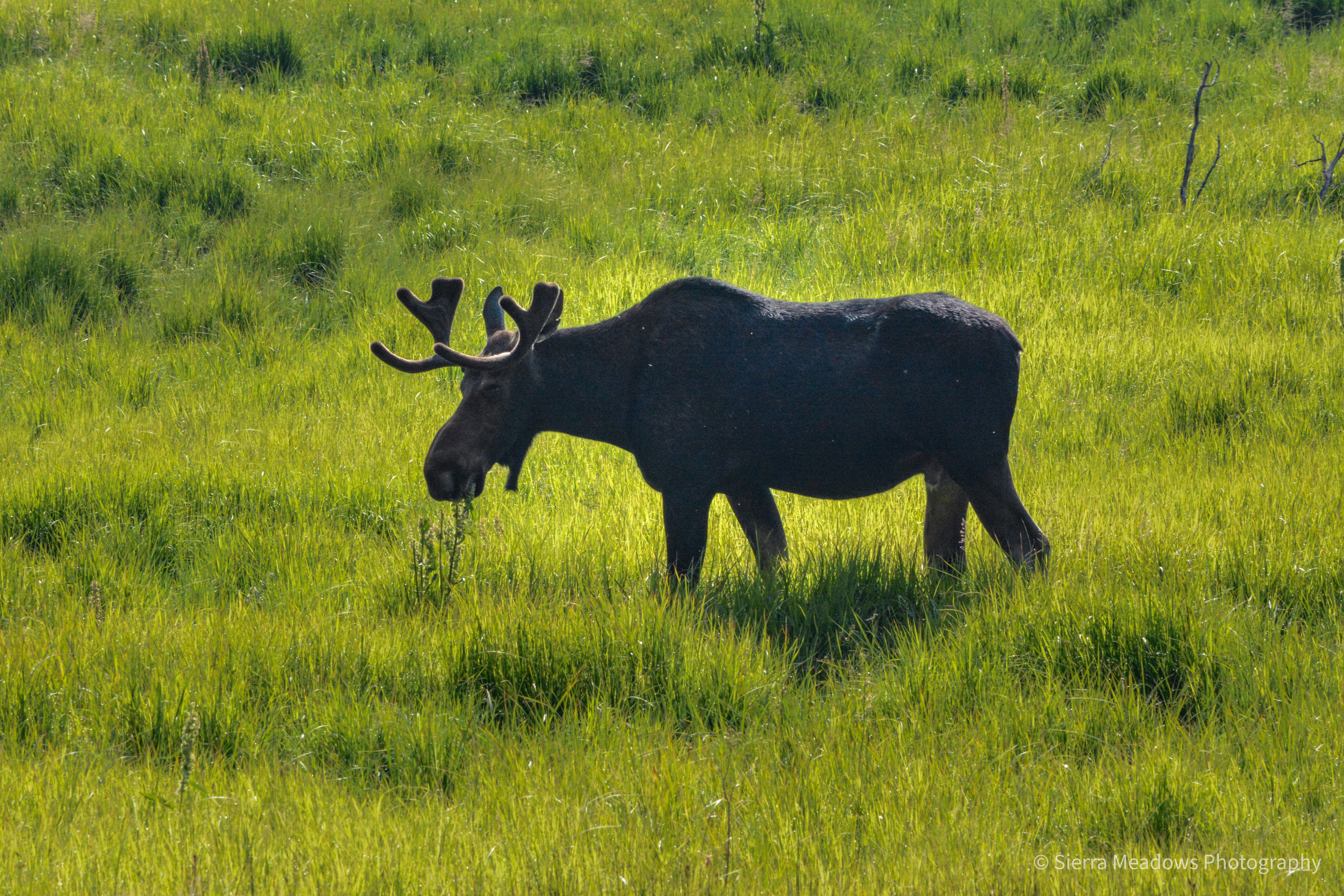
Since most of the campground signs were burned or missing, we think this was Sunrise Campground. When we got to sunrise, we scoped out a spot next to another backpacker. We felt safer at this one because there was some clear cleanup, another person nearby, and no overhead trees that could be knocked down. Aside from the burn, we had a view of an active meadow, complete with a moose that we saw around dinnertime and when we left to pack up the next morning.


Day Three:
We packed up, minding the moose trampling very close to our campground, and started our last stretch of this trail. It was much the same as it was since Timberline. As we passed more rugged spaces, we are thankful that we stopped where we did the night before.

Mile ~22.3: South Tonahutu/ Big Meadows/ Onahu Creek Trail
At this junction, Big Meadows was closed (which is where the original trail started from). Big Meadows is also the section that is on the CDT. We went left a couple of miles to Liverly Trail and back to the visitor’s center.
Mile ~26: Visitor’s Center
The visitor’s center was very crowded when we returned from our trek around noon. We washed up in the bathroom, went in to look around, and got back in the car to head the 2 hours back to Denver for the night.
Honorable Mention
- This trip was part of a larger trip in Colorado. You can read about it here. One of the trip highlights for me (aside from hiking!) was visiting Garden of the Gods in Colorado Springs.
- We spent the two nights before staring the trail at Winding River Resort, minutes from the trailhead.
Don’t forget to Leave No Trace!
~C
Post Notes:
~all mileage is approximate.
~1AllTrails lists Green Mountain Trailhead as the start of this trail. This was closed (as of January 2023 it is open) and the Ranger suggested parking and leaving from the visitor’s center. The trail mileage is ~2 miles (give or take) shorter.

Leave a comment